Morgan geodata
Morgan (Utah) is a seat of a second-order administrative division; located in United States in America/Denver (GMT-6) time zone. With population of 4,049 people, there are 8162 cities with bigger population in this country. Compared to other cities in United States, 66.3% of cities are located further ↓South; 86.8% of cities are located further →East and 97.1% of cities have lower elevation than Morgan. Note1


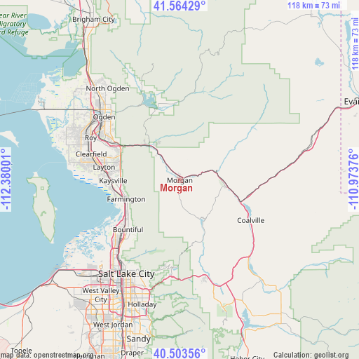
Morgan GPS coordinates[2]
41° 2' 9.816" North, 111° 40' 36.768" West
| Map corner | latitude | longitude |
|---|---|---|
| Upper-left | 41.56429°, | -112.38001° |
| Center: | 41.03606°, | -111.67688° |
| Lower-right: | 40.50356°, | -110.97376° |
| Map W x H: | 117.9×117.9 km | = 73.3×73.3mi |
| max Lat: | 71.29058° ⇑33.7% North |
| Morgan: | 41.03606° |
| min Lat: | ⇓66.3% South 19.06759° |
| min Long | Morgan | max Long |
| -171.73463° | -111.67688° | -66.98998° |
| W 13.2%⇐ | ⇒86.8% E |
Elevation
Elevation of Morgan is 1548 m = 5079 ft, and this is 1253.2 m = 4112 ft above average elevation for this country.
| Max E: |
3189 m = 10463 ft | 2.9% |
| Morgan | 1548 m 5079 ft | |
| Avg. | 294.8 m = 967 ft | |
Min E: |
-60 m = -197 ft | 97.1% |
See also: United States elevation on elevation.city.
Geographical zone
Morgan is located in North temperate zone (between Tropic of Cancer and the Arctic Circle). Distance of this Northern Tropic circle is 1956.9 km =1216 mi to South.| Distance of | km | miles | from Morgan |
|---|---|---|---|
| North Pole | 5444.3 | 3382.9 | to North |
| Arctic Circle | 2838.4 | 1763.7 | to North |
| Tropic Cancer | 1956.9 | 1216 | to South |
| Equator | 4562.8 | 2835.2 | to South |


Nearby cities:
15 places around Morgan: (largest is in red/bold)
• Bountiful
23.6 km =14.7 mi,  226°
226°
• Centerville
21 km =13 mi, 231°
• Enterprise
8.7 km =5.4 mi,  324°
324°
• Farmington
18.7 km =11.6 mi,  250°
250°
• Fruit Heights
18.9 km =11.7 mi,  268°
268°
• Henefer
15.1 km =9.4 mi,  98°
98°
• Hill Air Force Base
26.5 km =16.5 mi,  288°
288°
• Huntsville
26.2 km =16.3 mi,  342°
342°
• Kaysville
21.9 km =13.6 mi, 269°
• Layton
24.8 km =15.4 mi,  276°
276°
• Mountain Green
15.3 km =9.5 mi, 321°
• South Weber
23.8 km =14.8 mi,  296°
296°
• Uintah
23.9 km =14.9 mi, 300°
• West Bountiful
24.6 km =15.3 mi, 230°
• Woods Cross
25.7 km =16 mi,  224°
224°
Sources, notices
• [Note1] Compared only with cities in United States existing in our database
• [Src1] Map data: © OpenStreetMap contributors (CC-BY-SA)
• [Src2] Other city data from geonames.org with taken over terms of usage.
• [Src3] Geographical zone / Annual Mean Temperature by Robert A. Rohde @ Wikipedia
