Bellingham geodata
Bellingham (Washington) is a seat of a second-order administrative division; located in United States in America/Los_Angeles (GMT-7) time zone. With population of 85,146 people, there are 454 cities with bigger population in this country. Compared to other cities in United States, 99.3% of cities are located further ↓South; 96.6% of cities are located further →East and 87.8% of cities have higher elevation than Bellingham. Note1


Bellingham GPS coordinates[2]
48° 45' 34.38" North, 122° 29' 17.592" West
| Map corner | latitude | longitude |
|---|---|---|
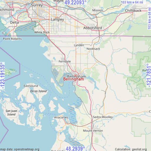
| Upper-left | 49.22093°, | -123.19135° |
| Center: | 48.75955°, | -122.48822° |
| Lower-right: | 48.2939°, | -121.7851° |
| Map W x H: | 103.1×103.1 km | = 64.1×64.1mi |
| max Lat: | 71.29058° ⇑0.7% North |
| Bellingham: | 48.75955° |
| min Lat: | ⇓99.3% South 19.06759° |
| min Long | Bellingham | max Long |
| -171.73463° | -122.48822° | -66.98998° |
| W 3.4%⇐ | ⇒96.6% E |
Elevation
Elevation of Bellingham is 21 m = 69 ft, and this is 273.8 m = 898 ft below average elevation for this country.
| Max E: |
3189 m = 10463 ft | 87.8% |
| Avg. | 294.8 m = 967 ft | |
| Bellingham | 21 m = 69 ft | |
Min E: |
-60 m = -197 ft | 12.2% |
See also: Bellingham elevation on elevation.city.
Geographical zone
Bellingham is located in North temperate zone (between Tropic of Cancer and the Arctic Circle). Distance of this North polar circle is 1979.6 km =1230.1 mi to North.| Distance of | km | miles | from Bellingham |
|---|---|---|---|
| North Pole | 4585.5 | 2849.3 | to North |
| Arctic Circle | 1979.6 | 1230.1 | to North |
| Tropic Cancer | 2815.6 | 1749.5 | to South |
| Equator | 5421.6 | 3368.8 | to South |


Nearby cities:
15 places around Bellingham: (largest is in red/bold)
• Anacortes
28.9 km =18 mi,  198°
198°
• Bay View
30.7 km =19.1 mi,  178°
178°
• Birch Bay
25.7 km =16 mi,  313°
313°
• Blaine
32.2 km =20 mi,  323°
323°
• Burlington
33.8 km =21 mi,  159°
159°
• Everson
20.8 km =12.9 mi,  30°
30°
• Ferndale
12.3 km =7.6 mi, 322°
• Geneva
6.5 km =4 mi,  103°
103°
• Lynden
21 km =13 mi,  7°
7°
• Marietta
7.4 km =4.6 mi,  294°
294°
• Marietta-Alderwood
5.8 km =3.6 mi,  304°
304°
• Nooksack
22.3 km =13.9 mi, 33°
• Peaceful Valley
31.9 km =19.8 mi,  51°
51°
• Sudden Valley
11.2 km =7 mi,  111°
111°
• Sumas
31.3 km =19.4 mi, 31°
Sources, notices
• [Note1] Compared only with cities in United States existing in our database
• [Src1] Map data: © OpenStreetMap contributors (CC-BY-SA)
• [Src2] Other city data from geonames.org with taken over terms of usage.
• [Src3] Geographical zone / Annual Mean Temperature by Robert A. Rohde @ Wikipedia
