Bothell geodata
Bothell (Washington) is a populated place; located in United States in America/Los_Angeles (GMT-7) time zone. With population of 42,939 people, there are 1111 cities with bigger population in this country. Compared to other cities in United States, 98.2% of cities are located further ↓South; 95.7% of cities are located further →East and 86.6% of cities have higher elevation than Bothell. Note1


Bothell GPS coordinates[2]
47° 45' 44.352" North, 122° 12' 19.44" West
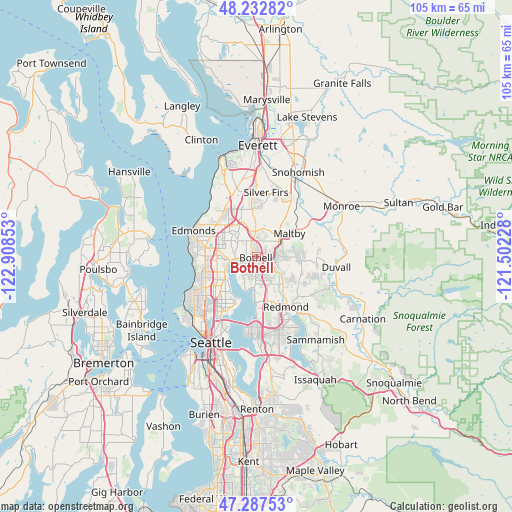
| Map corner | latitude | longitude |
|---|---|---|
| Upper-left | 48.23282°, | -122.90853° |
| Center: | 47.76232°, | -122.2054° |
| Lower-right: | 47.28753°, | -121.50228° |
| Map W x H: | 105.1×105.1 km | = 65.3×65.3mi |
| max Lat: | 71.29058° ⇑1.8% North |
| Bothell: | 47.76232° |
| min Lat: | ⇓98.2% South 19.06759° |
| min Long | Bothell | max Long |
| -171.73463° | -122.2054° | -66.98998° |
| W 4.3%⇐ | ⇒95.7% E |
Elevation
Elevation of Bothell is 24 m = 79 ft, and this is 270.8 m = 888 ft below average elevation for this country.
| Max E: |
3189 m = 10463 ft | 86.6% |
| Avg. | 294.8 m = 967 ft | |
| Bothell | 24 m = 79 ft | |
Min E: |
-60 m = -197 ft | 13.4% |
See also: Bothell elevation on elevation.city.
Geographical zone
Bothell is located in North temperate zone (between Tropic of Cancer and the Arctic Circle). Distance of this North polar circle is 2090.5 km =1299 mi to North.| Distance of | km | miles | from Bothell |
|---|---|---|---|
| North Pole | 4696.4 | 2918.2 | to North |
| Arctic Circle | 2090.5 | 1299 | to North |
| Tropic Cancer | 2704.8 | 1680.7 | to South |
| Equator | 5310.7 | 3299.9 | to South |


Nearby cities:
15 places around Bothell: (largest is in red/bold)
• Alderwood Manor
8.8 km =5.5 mi,  319°
319°
• Bothell East
5.1 km =3.2 mi,  17°
17°
• Bothell West
5.5 km =3.4 mi,  331°
331°
• Brier
5.7 km =3.5 mi,  295°
295°
• Inglewood-Finn Hill
5 km =3.1 mi,  202°
202°
• Kenmore
2.9 km =1.8 mi,  259°
259°
• Kingsgate
4.4 km =2.7 mi,  153°
153°
• Kirkland
9 km =5.6 mi,  181°
181°
• Lake Forest Park
5.7 km =3.5 mi, 263°
• Larch Way
9.6 km =6 mi,  338°
338°
• Maltby
8.4 km =5.2 mi,  55°
55°
• Mill Creek East
8.3 km =5.2 mi,  9°
9°
• Mountlake Terrace
8.2 km =5.1 mi,  290°
290°
• North Creek
6.7 km =4.2 mi, 18°
• Woodinville
3.3 km =2.1 mi,  105°
105°
Sources, notices
• [Note1] Compared only with cities in United States existing in our database
• [Src1] Map data: © OpenStreetMap contributors (CC-BY-SA)
• [Src2] Other city data from geonames.org with taken over terms of usage.
• [Src3] Geographical zone / Annual Mean Temperature by Robert A. Rohde @ Wikipedia
