Central Park geodata
Central Park (Washington) is a populated place; located in United States in America/Los_Angeles (GMT-7) time zone. With population of 2,685 people, there are 10209 cities with bigger population in this country. Compared to other cities in United States, 96.6% of cities are located further ↓South; 98.4% of cities are located further →East and 80.9% of cities have higher elevation than Central Park. Note1


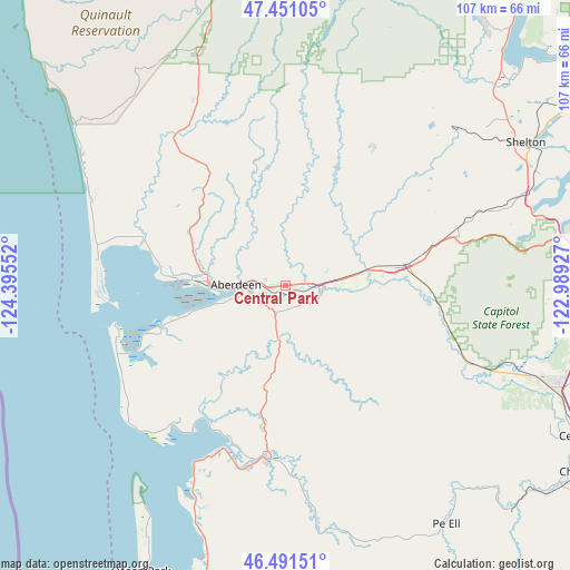
Central Park GPS coordinates[2]
46° 58' 24.348" North, 123° 41' 32.604" West
| Map corner | latitude | longitude |
|---|---|---|
| Upper-left | 47.45105°, | -124.39552° |
| Center: | 46.97343°, | -123.69239° |
| Lower-right: | 46.49151°, | -122.98927° |
| Map W x H: | 106.7×106.7 km | = 66.3×66.3mi |
| max Lat: | 71.29058° ⇑3.4% North |
| Central Park: | 46.97343° |
| min Lat: | ⇓96.6% South 19.06759° |
| min Long | Central Park | max Long |
| -171.73463° | -123.69239° | -66.98998° |
| W 1.6%⇐ | ⇒98.4% E |
Elevation
Elevation of Central Park is 43 m = 141 ft, and this is 251.8 m = 826 ft below average elevation for this country.
| Max E: |
3189 m = 10463 ft | 80.9% |
| Avg. | 294.8 m = 967 ft | |
| Central Park | 43 m = 141 ft | |
Min E: |
-60 m = -197 ft | 19.1% |
See also: United States elevation on elevation.city.
Geographical zone
Central Park is located in North temperate zone (between Tropic of Cancer and the Arctic Circle). Distance of this North polar circle is 2178.2 km =1353.5 mi to North.| Distance of | km | miles | from Central Park |
|---|---|---|---|
| North Pole | 4784.1 | 2972.7 | to North |
| Arctic Circle | 2178.2 | 1353.5 | to North |
| Tropic Cancer | 2617 | 1626.1 | to South |
| Equator | 5223 | 3245.4 | to South |


Nearby cities:
15 places around Central Park: (largest is in red/bold)
• Aberdeen
9.4 km =5.8 mi,  271°
271°
• Brady
13.9 km =8.6 mi,  79°
79°
• Cohassett Beach
33.9 km =21.1 mi,  249°
249°
• Cosmopolis
6.5 km =4 mi, 251°
• Elma
21.8 km =13.5 mi, 81°
• Grayland
35.5 km =22.1 mi,  239°
239°
• Hoquiam
15 km =9.3 mi, 273°
• McCleary
33.6 km =20.9 mi,  74°
74°
• Montesano
6.9 km =4.3 mi, 82°
• Oakville
37.9 km =23.5 mi,  112°
112°
• Ocean Shores
35.2 km =21.9 mi, 270°
• Raymond
32.1 km =19.9 mi,  185°
185°
• Satsop
16.2 km =10.1 mi, 78°
• South Bend
35.5 km =22.1 mi, 193°
• Westport
32.6 km =20.3 mi, 253°
Sources, notices
• [Note1] Compared only with cities in United States existing in our database
• [Src1] Map data: © OpenStreetMap contributors (CC-BY-SA)
• [Src2] Other city data from geonames.org with taken over terms of usage.
• [Src3] Geographical zone / Annual Mean Temperature by Robert A. Rohde @ Wikipedia
