Nānākuli geodata
Nānākuli (Hawaii) is a populated place; located in United States in Pacific/Honolulu (GMT-10) time zone. With population of 12,666 people, there are 3739 cities with bigger population in this country. Compared to other cities in United States, 99.6% of cities are located further ↑North; 99.7% of cities are located further →East and 97.4% of cities have higher elevation than Nānākuli. Note1


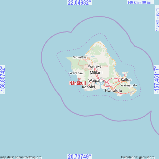
Nānākuli GPS coordinates[2]
21° 23' 37.032" North, 158° 9' 15.444" West
| Map corner | latitude | longitude |
|---|---|---|
| Upper-left | 22.04682°, | -158.85742° |
| Center: | 21.39362°, | -158.15429° |
| Lower-right: | 20.73749°, | -157.45117° |
| Map W x H: | 145.6×145.6 km | = 90.5×90.5mi |
| max Lat: | 71.29058° ⇑99.6% North |
| Nānākuli: | 21.39362° |
| min Lat: | ⇓0.4% South 19.06759° |
| min Long | Nānākuli | max Long |
| -171.73463° | -158.15429° | -66.98998° |
| W 0.3%⇐ | ⇒99.7% E |
Elevation
Elevation of Nānākuli is 6 m = 20 ft, and this is 288.8 m = 948 ft below average elevation for this country.
| Max E: |
3189 m = 10463 ft | 97.4% |
| Avg. | 294.8 m = 967 ft | |
| Nānākuli | 6 m = 20 ft | |
Min E: |
-60 m = -197 ft | 2.6% |
See also: United States elevation on elevation.city.
Geographical zone
Nānākuli is located in North Torrid zone (between Equator and Tropic of Cancer). Distance of this Northern Tropic circle is 227.2 km =141.2 mi to North.| Distance of | km | miles | from Nānākuli |
|---|---|---|---|
| North Pole | 7628.3 | 4740 | to North |
| Arctic Circle | 5022.4 | 3120.8 | to North |
| Tropic Cancer | 227.2 | 141.2 | to North |
| Equator | 2378.7 | 1478.1 | to South |


Nearby cities:
15 places around Nānākuli: (largest is in red/bold)
• Kapolei
11.9 km =7.4 mi,  122°
122°
• Ko Olina
6.7 km =4.2 mi,  153°
153°
• Makakilo
8.4 km =5.2 mi, 123°
• Makakilo City
8.8 km =5.5 mi,  126°
126°
• Mākaha
9.9 km =6.2 mi,  324°
324°
• Mākaha Valley
10.3 km =6.4 mi,  333°
333°
• Mā‘ili
3.3 km =2.1 mi, 319°
• Ocean Pointe
15.3 km =9.5 mi, 127°
• Royal Kunia
13.2 km =8.2 mi,  89°
89°
• Schofield Barracks
14.9 km =9.3 mi,  38°
38°
• Village Park
12.8 km =8 mi, 87°
• Waianae
5.9 km =3.7 mi, 326°
• Waipahu
15 km =9.3 mi, 92°
• ‘Ewa Gentry
14.1 km =8.8 mi,  114°
114°
• ‘Ewa Villages
13.2 km =8.2 mi, 116°
Sources, notices
• [Note1] Compared only with cities in United States existing in our database
• [Src1] Map data: © OpenStreetMap contributors (CC-BY-SA)
• [Src2] Other city data from geonames.org with taken over terms of usage.
• [Src3] Geographical zone / Annual Mean Temperature by Robert A. Rohde @ Wikipedia
