Pāhala geodata
Pāhala (Hawaii) is a populated place; located in United States in Pacific/Honolulu (GMT-10) time zone. With population of 1,356 people, there are 14319 cities with bigger population in this country. Compared to other cities in United States, 100% of cities are located further ↑North; 99.3% of cities are located further →East and 69.7% of cities have lower elevation than Pāhala. Note1


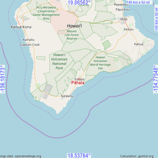
Pāhala GPS coordinates[2]
19° 12' 10.692" North, 155° 28' 42.96" West
| Map corner | latitude | longitude |
|---|---|---|
| Upper-left | 19.86562°, | -156.18173° |
| Center: | 19.20297°, | -155.4786° |
| Lower-right: | 18.53764°, | -154.77548° |
| Map W x H: | 147.7×147.7 km | = 91.8×91.8mi |
| max Lat: | 71.29058° ⇑100% North |
| Pāhala: | 19.20297° |
| min Lat: | ⇓0% South 19.06759° |
| min Long | Pāhala | max Long |
| -171.73463° | -155.4786° | -66.98998° |
| W 0.7%⇐ | ⇒99.3% E |
Elevation
Elevation of Pāhala is 284 m = 932 ft, and this is 10.8 m = 35 ft below average elevation for this country.
| Max E: |
3189 m = 10463 ft | 30.3% |
| Avg. | 294.8 m = 967 ft | |
| Pāhala | 284 m = 932 ft | |
Min E: |
-60 m = -197 ft | 69.7% |
See also: United States elevation on elevation.city.
Geographical zone
Pāhala is located in North Torrid zone (between Equator and Tropic of Cancer). Distance of this Northern Tropic circle is 470.7 km =292.5 mi to North.| Distance of | km | miles | from Pāhala |
|---|---|---|---|
| North Pole | 7871.9 | 4891.4 | to North |
| Arctic Circle | 5266 | 3272.1 | to North |
| Tropic Cancer | 470.7 | 292.5 | to North |
| Equator | 2135.2 | 1326.8 | to South |


Nearby cities:
15 places around Pāhala: (largest is in red/bold)
• Ainaloa
62.4 km =38.8 mi,  54°
54°
• Captain Cook
56.8 km =35.3 mi,  305°
305°
• Eden Roc
50.7 km =31.5 mi, 50°
• Fern Acres
54.1 km =33.6 mi, 50°
• Fern Forest
46.3 km =28.8 mi, 50°
• Hawaiian Acres
58.2 km =36.2 mi, 50°
• Hawaiian Ocean View
33.6 km =20.9 mi,  243°
243°
• Honalo
61 km =37.9 mi, 308°
• Honaunau-Napoopoo
49.3 km =30.6 mi,  304°
304°
• Kealakekua
58.5 km =36.4 mi, 307°
• Kurtistown
62.7 km =39 mi,  44°
44°
• Mountain View
55.2 km =34.3 mi, 44°
• Naalehu
18.4 km =11.4 mi,  215°
215°
• Orchidlands Estates
62.8 km =39 mi, 50°
• Volcano
37 km =23 mi, 43°
Sources, notices
• [Note1] Compared only with cities in United States existing in our database
• [Src1] Map data: © OpenStreetMap contributors (CC-BY-SA)
• [Src2] Other city data from geonames.org with taken over terms of usage.
• [Src3] Geographical zone / Annual Mean Temperature by Robert A. Rohde @ Wikipedia
