Butte-Silver Bow (Balance) geodata
Butte-Silver Bow (Balance) (Montana) is a populated place; located in United States in America/Denver (GMT-6) time zone. With population of 33,525 people, there are 1478 cities with bigger population in this country. Compared to other cities in United States, 94.9% of cities are located further ↓South; 88.1% of cities are located further →East and 98.3% of cities have lower elevation than Butte-Silver Bow (Balance). Note1
Current local time in Butte-Silver Bow (Balance):
11:47 PM, SundayDifference from your time zone: hours


Butte-Silver Bow (Balance) GPS coordinates[2]
45° 54' 6.984" North, 112° 39' 25.488" West
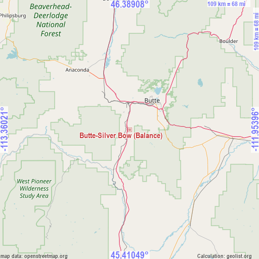
| Map corner | latitude | longitude |
|---|---|---|
| Upper-left | 46.38908°, | -113.36021° |
| Center: | 45.90194°, | -112.65708° |
| Lower-right: | 45.41049°, | -111.95396° |
| Map W x H: | 108.8×108.8 km | = 67.6×67.6mi |
| max Lat: | 71.29058° ⇑5.1% North |
| Butte-Silver Bow (Balance): | 45.90194° |
| min Lat: | ⇓94.9% South 19.06759° |
| min Long | Butte-Silver Bo | max Long |
| -171.73463° | -112.65708° | -66.98998° |
| W 11.9%⇐ | ⇒88.1% E |
Elevation
Elevation of Butte-Silver Bow (Balance) is 1776 m = 5827 ft, and this is 1481.2 m = 4860 ft above average elevation for this country.
| Max E: |
3189 m = 10463 ft | 1.7% |
| Butte-Silver Bow (Balance) | 1776 m 5827 ft | |
| Avg. | 294.8 m = 967 ft | |
Min E: |
-60 m = -197 ft | 98.3% |
See also: United States elevation on elevation.city.
Geographical zone
Butte-Silver Bow (Balance) is located in North temperate zone (between Tropic of Cancer and the Arctic Circle). Distance of this North polar circle is 2297.4 km =1427.5 mi to North.| Distance of | km | miles | from Butte-Silver Bow (Balance) |
|---|---|---|---|
| North Pole | 4903.2 | 3046.7 | to North |
| Arctic Circle | 2297.4 | 1427.5 | to North |
| Tropic Cancer | 2497.9 | 1552.1 | to South |
| Equator | 5103.8 | 3171.4 | to South |


Nearby cities:
15 places around Butte-Silver Bow (Balance): (largest is in red/bold)
• Anaconda
33.5 km =20.8 mi,  318°
318°
• Boulder
55.6 km =34.5 mi,  48°
48°
• Butte
14.8 km =9.2 mi,  39°
39°
• Clancy
81.2 km =50.5 mi, 39°
• Deer Lodge
55.2 km =34.3 mi,  354°
354°
• Dillon
76.3 km =47.4 mi,  178°
178°
• Helena West Side
87.9 km =54.6 mi,  28°
28°
• Philipsburg
68.6 km =42.6 mi,  314°
314°
• Sheridan
61.2 km =38 mi,  144°
144°
• South Hills
88.7 km =55.1 mi, 34°
• Three Forks
85.5 km =53.1 mi,  90°
90°
• Virginia City
87.4 km =54.3 mi, 140°
• Walkerville
17.4 km =10.8 mi, 32°
• Warm Springs
32.6 km =20.3 mi,  342°
342°
• Whitehall
43.4 km =27 mi, 94°
Sources, notices
• [Note1] Compared only with cities in United States existing in our database
• [Src1] Map data: © OpenStreetMap contributors (CC-BY-SA)
• [Src2] Other city data from geonames.org with taken over terms of usage.
• [Src3] Geographical zone / Annual Mean Temperature by Robert A. Rohde @ Wikipedia
