Wilson-Conococheague geodata
Wilson-Conococheague (Maryland) is a populated place; located in United States in America/New_York (GMT-4) time zone. With population of 2,282 people, there are 11128 cities with bigger population in this country. Compared to other cities in United States, 50.4% of cities are located further ↓South; 78.1% of cities are located further ←West and 64.2% of cities have higher elevation than Wilson-Conococheague. Note1


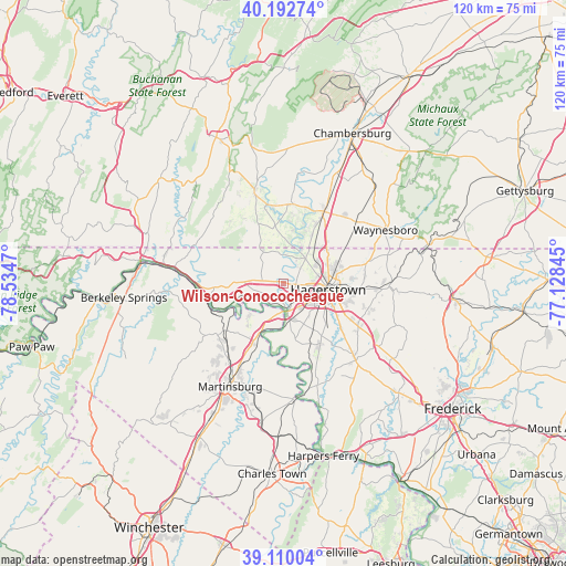
Wilson-Conococheague GPS coordinates[2]
39° 39' 12.636" North, 77° 49' 53.652" West
| Map corner | latitude | longitude |
|---|---|---|
| Upper-left | 40.19274°, | -78.5347° |
| Center: | 39.65351°, | -77.83157° |
| Lower-right: | 39.11004°, | -77.12845° |
| Map W x H: | 120.4×120.4 km | = 74.8×74.8mi |
| max Lat: | 71.29058° ⇑49.6% North |
| Wilson-Conococheague: | 39.65351° |
| min Lat: | ⇓50.4% South 19.06759° |
| min Long | Wilson-Conococh | max Long |
| -171.73463° | -77.83157° | -66.98998° |
| W 78.1%⇐ | ⇒21.9% E |
Elevation
Elevation of Wilson-Conococheague is 132 m = 433 ft, and this is 162.8 m = 534 ft below average elevation for this country.
| Max E: |
3189 m = 10463 ft | 64.2% |
| Avg. | 294.8 m = 967 ft | |
| Wilson-Conococheague | 132 m = 433 ft | |
Min E: |
-60 m = -197 ft | 35.8% |
See also: United States elevation on elevation.city.
Geographical zone
Wilson-Conococheague is located in North temperate zone (between Tropic of Cancer and the Arctic Circle). Distance of this Northern Tropic circle is 1803.1 km =1120.4 mi to South.| Distance of | km | miles | from Wilson-Conococheague |
|---|---|---|---|
| North Pole | 5598 | 3478.4 | to North |
| Arctic Circle | 2992.1 | 1859.2 | to North |
| Tropic Cancer | 1803.1 | 1120.4 | to South |
| Equator | 4409.1 | 2739.7 | to South |


Nearby cities:
15 places around Wilson-Conococheague: (largest is in red/bold)
• Fairplay
14.9 km =9.3 mi,  151°
151°
• Falling Waters
11.6 km =7.2 mi,  205°
205°
• Fountainhead-Orchard Hills
10.3 km =6.4 mi,  69°
69°
• Funkstown
12 km =7.5 mi,  114°
114°
• Greencastle
17.6 km =10.9 mi,  30°
30°
• Hagerstown
9.6 km =6 mi,  97°
97°
• Halfway
7.2 km =4.5 mi,  120°
120°
• Leitersburg
18.4 km =11.4 mi,  76°
76°
• Maugansville
8.6 km =5.3 mi,  59°
59°
• Mount Aetna
18.7 km =11.6 mi, 107°
• Paramount-Long Meadow
12.2 km =7.6 mi, 75°
• Robinwood
15.1 km =9.4 mi, 96°
• Saint James
11.9 km =7.4 mi, 148°
• State Line
12.1 km =7.5 mi,  49°
49°
• Williamsport
6 km =3.7 mi,  170°
170°
Sources, notices
• [Note1] Compared only with cities in United States existing in our database
• [Src1] Map data: © OpenStreetMap contributors (CC-BY-SA)
• [Src2] Other city data from geonames.org with taken over terms of usage.
• [Src3] Geographical zone / Annual Mean Temperature by Robert A. Rohde @ Wikipedia
