Lagunitas-Forest Knolls geodata
Lagunitas-Forest Knolls (California) is a populated place; located in United States in America/Los_Angeles (GMT-7) time zone. With population of 1,819 people, there are 12476 cities with bigger population in this country. Compared to other cities in United States, 61.5% of cities are located further ↑North; 97.2% of cities are located further →East and 66.4% of cities have higher elevation than Lagunitas-Forest Knolls. Note1
Current local time in Lagunitas-Forest Knolls:
03:33 AM, FridayDifference from your time zone: hours


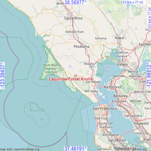
Lagunitas-Forest Knolls GPS coordinates[2]
38° 1' 4.548" North, 122° 41' 28.464" West
| Map corner | latitude | longitude |
|---|---|---|
| Upper-left | 38.56977°, | -123.39437° |
| Center: | 38.01793°, | -122.69124° |
| Lower-right: | 37.46191°, | -121.98812° |
| Map W x H: | 123.2×123.2 km | = 76.6×76.6mi |
| max Lat: | 71.29058° ⇑61.5% North |
| Lagunitas-Forest Knolls: | 38.01793° |
| min Lat: | ⇓38.5% South 19.06759° |
| min Long | Lagunitas-Fores | max Long |
| -171.73463° | -122.69124° | -66.98998° |
| W 2.8%⇐ | ⇒97.2% E |
Elevation
Elevation of Lagunitas-Forest Knolls is 121 m = 397 ft, and this is 173.8 m = 570 ft below average elevation for this country.
| Max E: |
3189 m = 10463 ft | 66.4% |
| Avg. | 294.8 m = 967 ft | |
| Lagunitas-Forest Knolls | 121 m = 397 ft | |
Min E: |
-60 m = -197 ft | 33.6% |
See also: United States elevation on elevation.city.
Geographical zone
Lagunitas-Forest Knolls is located in North temperate zone (between Tropic of Cancer and the Arctic Circle). Distance of this Northern Tropic circle is 1621.3 km =1007.4 mi to South.| Distance of | km | miles | from Lagunitas-Forest Knolls |
|---|---|---|---|
| North Pole | 5779.9 | 3591.5 | to North |
| Arctic Circle | 3174 | 1972.2 | to North |
| Tropic Cancer | 1621.3 | 1007.4 | to South |
| Equator | 4227.2 | 2626.7 | to South |


Nearby cities:
15 places around Lagunitas-Forest Knolls: (largest is in red/bold)
• Bolinas
12.1 km =7.5 mi,  177°
177°
• Fairfax
9.6 km =6 mi,  110°
110°
• Inverness
17.2 km =10.7 mi,  302°
302°
• Kentfield
13.8 km =8.6 mi,  121°
121°
• Larkspur
16.5 km =10.3 mi, 124°
• Lucas Valley-Marinwood
10.4 km =6.5 mi,  76°
76°
• Novato
14.6 km =9.1 mi,  46°
46°
• Point Reyes Station
11.6 km =7.2 mi, 299°
• Ross
13.4 km =8.3 mi, 117°
• San Anselmo
12.3 km =7.6 mi, 112°
• San Rafael
14.9 km =9.3 mi, 109°
• Santa Venetia
14.7 km =9.1 mi,  98°
98°
• Sleepy Hollow
9.4 km =5.8 mi, 95°
• Stinson Beach
13.7 km =8.5 mi,  162°
162°
• Woodacre
4.1 km =2.5 mi, 98°
Sources, notices
• [Note1] Compared only with cities in United States existing in our database
• [Src1] Map data: © OpenStreetMap contributors (CC-BY-SA)
• [Src2] Other city data from geonames.org with taken over terms of usage.
• [Src3] Geographical zone / Annual Mean Temperature by Robert A. Rohde @ Wikipedia
