Smithville-Sanders geodata
Smithville-Sanders (Indiana) is a populated place; located in United States in America/Indiana/Indianapolis (GMT-4) time zone. With population of 3,184 people, there are 9325 cities with bigger population in this country. Compared to other cities in United States, 54.3% of cities are located further ↑North; 51.5% of cities are located further ←West and 55.8% of cities have lower elevation than Smithville-Sanders. Note1
Administrative division(s):
- Level 1: Indiana
- Level 2: Monroe County
- Level 3: Township of Clear Creek


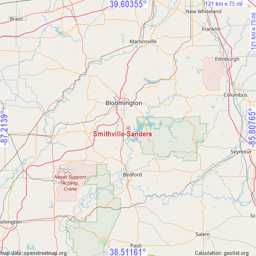
Smithville-Sanders GPS coordinates[2]
39° 3' 34.884" North, 86° 30' 38.772" West
| Map corner | latitude | longitude |
|---|---|---|
| Upper-left | 39.60355°, | -87.2139° |
| Center: | 39.05969°, | -86.51077° |
| Lower-right: | 38.51161°, | -85.80765° |
| Map W x H: | 121.4×121.4 km | = 75.4×75.4mi |
| max Lat: | 71.29058° ⇑54.3% North |
| Smithville-Sanders: | 39.05969° |
| min Lat: | ⇓45.7% South 19.06759° |
| min Long | Smithville-Sand | max Long |
| -171.73463° | -86.51077° | -66.98998° |
| W 51.5%⇐ | ⇒48.5% E |
Elevation
Elevation of Smithville-Sanders is 222 m = 728 ft, and this is 72.8 m = 239 ft below average elevation for this country.
| Max E: |
3189 m = 10463 ft | 44.2% |
| Avg. | 294.8 m = 967 ft | |
| Smithville-Sanders | 222 m = 728 ft | |
Min E: |
-60 m = -197 ft | 55.8% |
See also: United States elevation on elevation.city.
Geographical zone
Smithville-Sanders is located in North temperate zone (between Tropic of Cancer and the Arctic Circle). Distance of this Northern Tropic circle is 1737.1 km =1079.4 mi to South.| Distance of | km | miles | from Smithville-Sanders |
|---|---|---|---|
| North Pole | 5664 | 3519.4 | to North |
| Arctic Circle | 3058.1 | 1900.2 | to North |
| Tropic Cancer | 1737.1 | 1079.4 | to South |
| Equator | 4343 | 2698.6 | to South |


Nearby cities:
15 places around Smithville-Sanders: (largest is in red/bold)
• Avoca
16.7 km =10.4 mi,  191°
191°
• Bedford
22.2 km =13.8 mi,  174°
174°
• Bloomfield
37 km =23 mi,  264°
264°
• Bloomington
11.8 km =7.3 mi,  353°
353°
• Ellettsville
21.7 km =13.5 mi,  333°
333°
• Gosport
35.1 km =21.8 mi,  337°
337°
• Harrodsburg
5.9 km =3.7 mi,  209°
209°
• Medora
39.4 km =24.5 mi,  131°
131°
• Mitchell
36.5 km =22.7 mi, 174°
• Morgantown
40.8 km =25.4 mi,  31°
31°
• Nashville
27.8 km =17.3 mi,  53°
53°
• Oolitic
17.7 km =11 mi,  184°
184°
• Painted Hills
40 km =24.9 mi,  20°
20°
• Paragon
37.6 km =23.4 mi, 353°
• Spencer
33.3 km =20.7 mi,  319°
319°
Sources, notices
• [Note1] Compared only with cities in United States existing in our database
• [Src1] Map data: © OpenStreetMap contributors (CC-BY-SA)
• [Src2] Other city data from geonames.org with taken over terms of usage.
• [Src3] Geographical zone / Annual Mean Temperature by Robert A. Rohde @ Wikipedia
