Spencer geodata
Spencer (Indiana) is a seat of a second-order administrative division; located in United States in America/Indiana/Indianapolis (GMT-4) time zone. With population of 2,271 people, there are 11156 cities with bigger population in this country. Compared to other cities in United States, 52.3% of cities are located further ↑North; 50.9% of cities are located further ←West and 56.6% of cities have higher elevation than Spencer. Note1


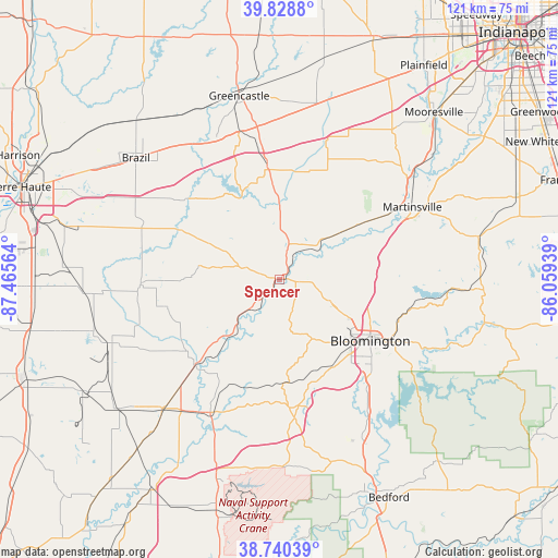
Spencer GPS coordinates[2]
39° 17' 12.156" North, 86° 45' 45.036" West
| Map corner | latitude | longitude |
|---|---|---|
| Upper-left | 39.8288°, | -87.46564° |
| Center: | 39.28671°, | -86.76251° |
| Lower-right: | 38.74039°, | -86.05939° |
| Map W x H: | 121×121 km | = 75.2×75.2mi |
| max Lat: | 71.29058° ⇑52.3% North |
| Spencer: | 39.28671° |
| min Lat: | ⇓47.7% South 19.06759° |
| min Long | Spencer | max Long |
| -171.73463° | -86.76251° | -66.98998° |
| W 50.9%⇐ | ⇒49.1% E |
Elevation
Elevation of Spencer is 173 m = 568 ft, and this is 121.8 m = 400 ft below average elevation for this country.
| Max E: |
3189 m = 10463 ft | 56.6% |
| Avg. | 294.8 m = 967 ft | |
| Spencer | 173 m = 568 ft | |
Min E: |
-60 m = -197 ft | 43.4% |
See also: United States elevation on elevation.city.
Geographical zone
Spencer is located in North temperate zone (between Tropic of Cancer and the Arctic Circle). Distance of this Northern Tropic circle is 1762.4 km =1095.1 mi to South.| Distance of | km | miles | from Spencer |
|---|---|---|---|
| North Pole | 5638.8 | 3503.8 | to North |
| Arctic Circle | 3032.9 | 1884.6 | to North |
| Tropic Cancer | 1762.4 | 1095.1 | to South |
| Equator | 4368.3 | 2714.3 | to South |


Nearby cities:
15 places around Spencer: (largest is in red/bold)
• Bloomfield
32.6 km =20.3 mi,  207°
207°
• Bloomington
24.4 km =15.2 mi,  123°
123°
• Clay City
30.2 km =18.8 mi,  267°
267°
• Cloverdale
25.5 km =15.8 mi,  353°
353°
• Ellettsville
13.2 km =8.2 mi, 116°
• Gosport
10.9 km =6.8 mi,  49°
49°
• Harrodsburg
35.7 km =22.2 mi,  148°
148°
• Jasonville
40 km =24.9 mi,  249°
249°
• Knightsville
40.1 km =24.9 mi,  311°
311°
• Martinsville
32.7 km =20.3 mi,  61°
61°
• Middlebury
30.8 km =19.1 mi, 265°
• Painted Hills
37.8 km =23.5 mi,  71°
71°
• Paragon
21 km =13 mi, 54°
• Smithville-Sanders
33.3 km =20.7 mi,  139°
139°
• Worthington
25.9 km =16.1 mi,  226°
226°
Sources, notices
• [Note1] Compared only with cities in United States existing in our database
• [Src1] Map data: © OpenStreetMap contributors (CC-BY-SA)
• [Src2] Other city data from geonames.org with taken over terms of usage.
• [Src3] Geographical zone / Annual Mean Temperature by Robert A. Rohde @ Wikipedia
