Punta de Piedra geodata
Punta de Piedra (Barinas) is a seat of a third-order administrative division; located in Venezuela in America/Caracas (GMT-4) time zone. In our database, there are 108 cities with bigger population. Compared to other cities in Venezuela, 94.9% of cities are located further ↑North; 86.8% of cities are located further →East and 50.1% of cities have lower elevation than Punta de Piedra. Note1
Administrative division(s):
- Level 1: Barinas
- Level 2: Municipio Ezequiel Zamora
- Level 3: Parroquia Ramón Ignacio Méndez


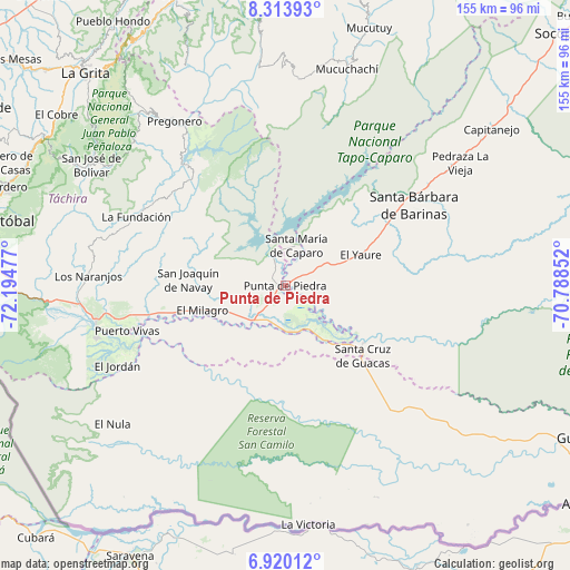
Punta de Piedra GPS coordinates[2]
7° 37' 3.324" North, 71° 29' 29.904" West
| Map corner | latitude | longitude |
|---|---|---|
| Upper-left | 8.31393°, | -72.19477° |
| Center: | 7.61759°, | -71.49164° |
| Lower-right: | 6.92012°, | -70.78852° |
| Map W x H: | 155×155 km | = 96.3×96.3mi |
| max Lat: | 11.94788° ⇑94.9% North |
| Punta de Piedra: | 7.61759° |
| min Lat: | ⇓5.1% South 1.92027° |
| min Long | Punta de Piedra | max Long |
| -72.55212° | -71.49164° | -60.99778° |
| W 13.2%⇐ | ⇒86.8% E |
Elevation
Elevation of Punta de Piedra is 179 m = 587 ft, and this is 201.6 m = 661 ft below average elevation for this country.
| Max E: |
2986 m = 9797 ft | 49.9% |
| Avg. | 380.6 m = 1249 ft | |
| Punta de Piedra | 179 m = 587 ft | |
Min E: |
-4 m = -13 ft | 50.1% |
See also: Venezuela elevation on elevation.city.
Geographical zone
Punta de Piedra is located in North Torrid zone (between Equator and Tropic of Cancer). Distance of Equator is 847 km =526.3 mi to South.| Distance of | km | miles | from Punta de Piedra |
|---|---|---|---|
| North Pole | 9160.1 | 5691.8 | to North |
| Arctic Circle | 6554.2 | 4072.6 | to North |
| Tropic Cancer | 1758.9 | 1092.9 | to North |
| Equator | 847 | 526.3 | to South |


Nearby cities:
15 places around Punta de Piedra: (largest is in red/bold)
• Abejales
2.2 km =1.4 mi,  287°
287°
• Canaguá
56.5 km =35.1 mi,  3°
3°
• Capitanejo
69.3 km =43.1 mi,  50°
50°
• El Cantón
26.5 km =16.5 mi,  125°
125°
• El Cobre
77.7 km =48.3 mi,  306°
306°
• Guaraque
65.4 km =40.6 mi,  335°
335°
• Pedraza La Vieja
58.1 km =36.1 mi,  55°
55°
• Pregonero
53.9 km =33.5 mi,  325°
325°
• Puerto Vivas
41 km =25.5 mi,  251°
251°
• Queniquea
66.4 km =41.3 mi,  300°
300°
• San José de Bolívar
62.3 km =38.7 mi, 301°
• San Rafael del Piñal
52.5 km =32.6 mi,  259°
259°
• Santa Bárbara
40.9 km =25.4 mi, 57°
• Santa Cruz de Guacas
28.6 km =17.8 mi, 132°
• Santa María de Caparo
11.1 km =6.9 mi,  15°
15°
Sources, notices
• [Note1] Compared only with cities in Venezuela existing in our database
• [Src1] Map data: © OpenStreetMap contributors (CC-BY-SA)
• [Src2] Other city data from geonames.org with taken over terms of usage.
• [Src3] Geographical zone / Annual Mean Temperature by Robert A. Rohde @ Wikipedia
