Pedraza La Vieja geodata
Pedraza La Vieja (Barinas) is a seat of a third-order administrative division; located in Venezuela in America/Caracas (GMT-4) time zone. In our database, there are 108 cities with bigger population. Compared to other cities in Venezuela, 89.1% of cities are located further ↑North; 80.7% of cities are located further →East and 54.2% of cities have lower elevation than Pedraza La Vieja. Note1


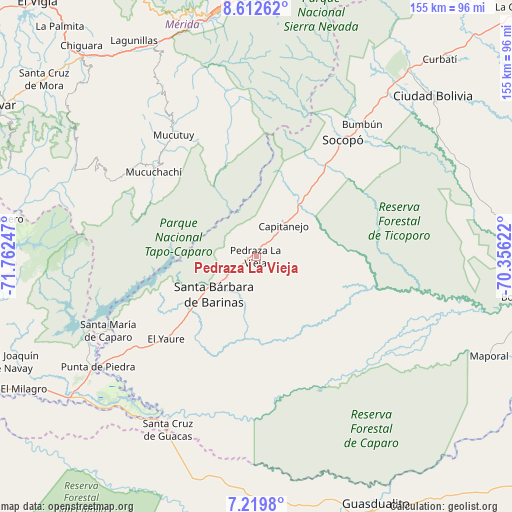
Pedraza La Vieja GPS coordinates[2]
7° 55' 0.48" North, 71° 3' 33.624" West
| Map corner | latitude | longitude |
|---|---|---|
| Upper-left | 8.61262°, | -71.76247° |
| Center: | 7.9168°, | -71.05934° |
| Lower-right: | 7.2198°, | -70.35622° |
| Map W x H: | 154.9×154.9 km | = 96.3×96.3mi |
| max Lat: | 11.94788° ⇑89.1% North |
| Pedraza La Vieja: | 7.9168° |
| min Lat: | ⇓10.9% South 1.92027° |
| min Long | Pedraza La Viej | max Long |
| -72.55212° | -71.05934° | -60.99778° |
| W 19.3%⇐ | ⇒80.7% E |
Elevation
Elevation of Pedraza La Vieja is 205 m = 673 ft, and this is 175.6 m = 576 ft below average elevation for this country.
| Max E: |
2986 m = 9797 ft | 45.8% |
| Avg. | 380.6 m = 1249 ft | |
| Pedraza La Vieja | 205 m = 673 ft | |
Min E: |
-4 m = -13 ft | 54.2% |
See also: Venezuela elevation on elevation.city.
Geographical zone
Pedraza La Vieja is located in North Torrid zone (between Equator and Tropic of Cancer). Distance of Equator is 880.3 km =547 mi to South.| Distance of | km | miles | from Pedraza La Vieja |
|---|---|---|---|
| North Pole | 9126.8 | 5671.1 | to North |
| Arctic Circle | 6520.9 | 4051.9 | to North |
| Tropic Cancer | 1725.7 | 1072.3 | to North |
| Equator | 880.3 | 547 | to South |


Nearby cities:
15 places around Pedraza La Vieja: (largest is in red/bold)
• Abejales
59.4 km =36.9 mi,  236°
236°
• Aricagua
35.3 km =21.9 mi,  345°
345°
• Bum Bum
51.4 km =31.9 mi,  38°
38°
• Canaguá
49.9 km =31 mi,  297°
297°
• Capitanejo
12.2 km =7.6 mi,  29°
29°
• Chameta
26.4 km =16.4 mi, 39°
• Ciudad Bolivia
72.4 km =45 mi,  47°
47°
• Ejido
72.8 km =45.2 mi,  344°
344°
• El Cantón
55.4 km =34.4 mi,  208°
208°
• Mucumpiz
56.2 km =34.9 mi, 351°
• Punta de Piedra
58.1 km =36.1 mi, 235°
• Santa Bárbara
17.4 km =10.8 mi,  228°
228°
• Santa Cruz de Guacas
59 km =36.7 mi, 206°
• Santa María de Caparo
50 km =31.1 mi, 243°
• Socopó
43.6 km =27.1 mi, 36°
Sources, notices
• [Note1] Compared only with cities in Venezuela existing in our database
• [Src1] Map data: © OpenStreetMap contributors (CC-BY-SA)
• [Src2] Other city data from geonames.org with taken over terms of usage.
• [Src3] Geographical zone / Annual Mean Temperature by Robert A. Rohde @ Wikipedia
