San Rafael del Piñal geodata
San Rafael del Piñal (Táchira) is a seat of a second-order administrative division; located in Venezuela in America/Caracas (GMT-4) time zone. In our database, there are 108 cities with bigger population. Compared to other cities in Venezuela, 95.4% of cities are located further ↑North; 92.6% of cities are located further →East and 61.3% of cities have lower elevation than San Rafael del Piñal. Note1


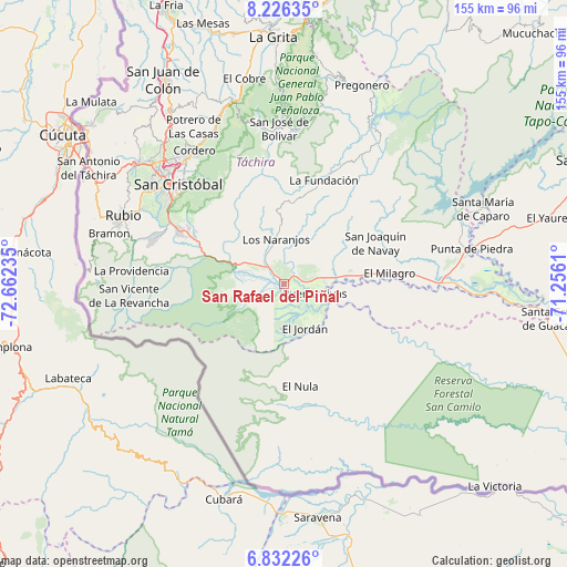
San Rafael del Piñal GPS coordinates[2]
7° 31' 47.532" North, 71° 57' 33.192" West
| Map corner | latitude | longitude |
|---|---|---|
| Upper-left | 8.22635°, | -72.66235° |
| Center: | 7.52987°, | -71.95922° |
| Lower-right: | 6.83226°, | -71.2561° |
| Map W x H: | 155×155 km | = 96.3×96.3mi |
| max Lat: | 11.94788° ⇑95.4% North |
| San Rafael del Piñal: | 7.52987° |
| min Lat: | ⇓4.6% South 1.92027° |
| min Long | San Rafael del | max Long |
| -72.55212° | -71.95922° | -60.99778° |
| W 7.4%⇐ | ⇒92.6% E |
Elevation
Elevation of San Rafael del Piñal is 270 m = 886 ft, and this is 110.6 m = 363 ft below average elevation for this country.
| Max E: |
2986 m = 9797 ft | 38.7% |
| Avg. | 380.6 m = 1249 ft | |
| San Rafael del Piñal | 270 m = 886 ft | |
Min E: |
-4 m = -13 ft | 61.3% |
See also: Venezuela elevation on elevation.city.
Geographical zone
San Rafael del Piñal is located in North Torrid zone (between Equator and Tropic of Cancer). Distance of Equator is 837.2 km =520.2 mi to South.| Distance of | km | miles | from San Rafael del Piñal |
|---|---|---|---|
| North Pole | 9169.8 | 5697.8 | to North |
| Arctic Circle | 6563.9 | 4078.6 | to North |
| Tropic Cancer | 1768.7 | 1099 | to North |
| Equator | 837.2 | 520.2 | to South |


Nearby cities:
15 places around San Rafael del Piñal: (largest is in red/bold)
• Abejales
50.6 km =31.4 mi,  78°
78°
• Capacho Nuevo
50.5 km =31.4 mi,  310°
310°
• Capacho Viejo
51.8 km =32.2 mi, 309°
• Cordero
43.8 km =27.2 mi,  326°
326°
• Delicias
54 km =33.6 mi,  274°
274°
• Palmira
45.2 km =28.1 mi,  319°
319°
• Puerto Vivas
13.1 km =8.1 mi,  104°
104°
• Punta de Piedra
52.5 km =32.6 mi, 79°
• Queniquea
43.4 km =27 mi,  352°
352°
• Rubio
47.7 km =29.6 mi,  293°
293°
• San Cristóbal
39.4 km =24.5 mi, 311°
• San Josecito
32.2 km =20 mi,  296°
296°
• San José de Bolívar
42.6 km =26.5 mi,  358°
358°
• Santa Ana
37.2 km =23.1 mi, 289°
• Táriba
43.4 km =27 mi, 317°
Sources, notices
• [Note1] Compared only with cities in Venezuela existing in our database
• [Src1] Map data: © OpenStreetMap contributors (CC-BY-SA)
• [Src2] Other city data from geonames.org with taken over terms of usage.
• [Src3] Geographical zone / Annual Mean Temperature by Robert A. Rohde @ Wikipedia
