Socopó geodata
Socopó (Barinas) is a seat of a second-order administrative division; located in Venezuela in America/Caracas (GMT-4) time zone. In our database, there are 108 cities with bigger population. Compared to other cities in Venezuela, 80.9% of cities are located further ↑North; 78.4% of cities are located further →East and 59% of cities have lower elevation than Socopó. Note1
Administrative division(s):
- Level 1: Barinas
- Level 2: Municipio Antonio José de Sucre
- Level 3: Parroquia Ticoporo


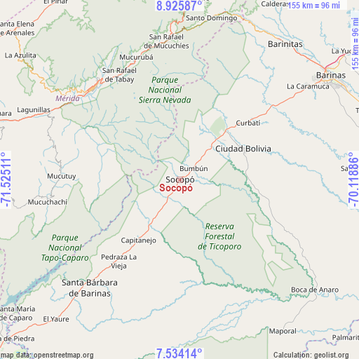
Socopó GPS coordinates[2]
8° 13' 50.232" North, 70° 49' 19.128" West
| Map corner | latitude | longitude |
|---|---|---|
| Upper-left | 8.92587°, | -71.52511° |
| Center: | 8.23062°, | -70.82198° |
| Lower-right: | 7.53414°, | -70.11886° |
| Map W x H: | 154.7×154.7 km | = 96.1×96.1mi |
| max Lat: | 11.94788° ⇑80.9% North |
| Socopó: | 8.23062° |
| min Lat: | ⇓19.1% South 1.92027° |
| min Long | Socopó | max Long |
| -72.55212° | -70.82198° | -60.99778° |
| W 21.6%⇐ | ⇒78.4% E |
Elevation
Elevation of Socopó is 240 m = 787 ft, and this is 140.6 m = 461 ft below average elevation for this country.
| Max E: |
2986 m = 9797 ft | 41% |
| Avg. | 380.6 m = 1249 ft | |
| Socopó | 240 m = 787 ft | |
Min E: |
-4 m = -13 ft | 59% |
See also: Venezuela elevation on elevation.city.
Geographical zone
Socopó is located in North Torrid zone (between Equator and Tropic of Cancer). Distance of Equator is 915.2 km =568.7 mi to South.| Distance of | km | miles | from Socopó |
|---|---|---|---|
| North Pole | 9091.9 | 5649.4 | to North |
| Arctic Circle | 6486 | 4030.2 | to North |
| Tropic Cancer | 1690.8 | 1050.6 | to North |
| Equator | 915.2 | 568.7 | to South |


Nearby cities:
15 places around Socopó: (largest is in red/bold)
• Aricagua
34.7 km =21.6 mi,  268°
268°
• Bum Bum
8 km =5 mi,  49°
49°
• Capitanejo
31.6 km =19.6 mi,  219°
219°
• Chameta
17.2 km =10.7 mi,  212°
212°
• Ciudad Bolivia
30.8 km =19.1 mi,  63°
63°
• Curbatí
38.5 km =23.9 mi, 49°
• Ejido
57.9 km =36 mi,  307°
307°
• El Corozo
63.3 km =39.3 mi, 53°
• La Mula
62 km =38.5 mi, 52°
• Mucuchíes
58.7 km =36.5 mi,  349°
349°
• Mucumpiz
40 km =24.9 mi,  301°
301°
• Mérida
54.3 km =33.7 mi,  317°
317°
• Pedraza La Vieja
43.6 km =27.1 mi, 216°
• Santa Bárbara
60.7 km =37.7 mi, 220°
• Tabay
52.8 km =32.8 mi,  327°
327°
Sources, notices
• [Note1] Compared only with cities in Venezuela existing in our database
• [Src1] Map data: © OpenStreetMap contributors (CC-BY-SA)
• [Src2] Other city data from geonames.org with taken over terms of usage.
• [Src3] Geographical zone / Annual Mean Temperature by Robert A. Rohde @ Wikipedia
