Đăk Đoa geodata
Đăk Đoa (Gia Lai) is a seat of a second-order administrative division; located in Vietnam in Asia/Ho_Chi_Minh (GMT+7) time zone. In our database, there are 94 cities with bigger population. Compared to other cities in Vietnam, 60.4% of cities are located further ↑North; 85.8% of cities are located further ←West and 95.6% of cities have lower elevation than Đăk Đoa. Note1


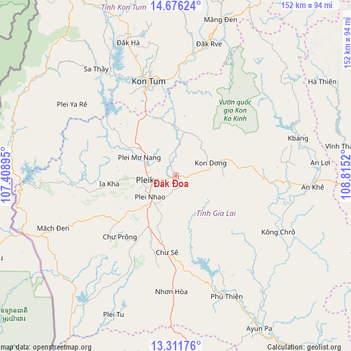
Đăk Đoa GPS coordinates[2]
13° 59' 42.036" North, 108° 6' 43.452" East
| Map corner | latitude | longitude |
|---|---|---|
| Upper-left | 14.67624°, | 107.40895° |
| Center: | 13.99501°, | 108.11207° |
| Lower-right: | 13.31176°, | 108.8152° |
| Map W x H: | 151.7×151.7 km | = 94.3×94.3mi |
| max Lat: | 23.27841° ⇑60.4% North |
| Đăk Đoa: | 13.99501° |
| min Lat: | ⇓39.6% South 8.65724° |
| min Long | Đăk Đoa | max Long |
| 102.4579° | 108.11207° | 112.72541° |
| W 85.8%⇐ | ⇒14.2% E |
Elevation
Elevation of Đăk Đoa is 744 m = 2441 ft, and this is 614.5 m = 2016 ft above average elevation for this country.
| Max E: |
1592 m = 5223 ft | 4.4% |
| Đăk Đoa | 744 m 2441 ft | |
| Avg. | 129.5 m = 425 ft | |
Min E: |
-1 m = -3 ft | 95.6% |
See also: Vietnam elevation on elevation.city.
Geographical zone
Đăk Đoa is located in North Torrid zone (between Equator and Tropic of Cancer). Distance of this Northern Tropic circle is 1049.8 km =652.3 mi to North.| Distance of | km | miles | from Đăk Đoa |
|---|---|---|---|
| North Pole | 8451 | 5251.2 | to North |
| Arctic Circle | 5845.1 | 3632 | to North |
| Tropic Cancer | 1049.8 | 652.3 | to North |
| Equator | 1556.1 | 966.9 | to South |


Nearby cities:
15 places around Đăk Đoa: (largest is in red/bold)
• Chư Prông
36 km =22.4 mi,  222°
222°
• Chư Sê
33.9 km =21.1 mi,  185°
185°
• Chư Ty
49.6 km =30.8 mi,  244°
244°
• Ia Kha
29.1 km =18.1 mi,  262°
262°
• Ia Pa
63.3 km =39.3 mi,  144°
144°
• K Bang
55.1 km =34.2 mi,  72°
72°
• Kon Dơng
15.7 km =9.8 mi, 71°
• Kon Tum
41.5 km =25.8 mi,  344°
344°
• Kông Chro
50.9 km =31.6 mi,  118°
118°
• Măng Đen
70 km =43.5 mi,  15°
15°
• Phú Hòa
19.4 km =12.1 mi,  307°
307°
• Pleiku
12.2 km =7.6 mi, 263°
• Sa Thầy
57.9 km =36 mi,  323°
323°
• Đắk Hà
61.2 km =38 mi, 340°
• Đắk Rve
58.8 km =36.5 mi,  14°
14°
Sources, notices
• [Note1] Compared only with cities in Vietnam existing in our database
• [Src1] Map data: © OpenStreetMap contributors (CC-BY-SA)
• [Src2] Other city data from geonames.org with taken over terms of usage.
• [Src3] Geographical zone / Annual Mean Temperature by Robert A. Rohde @ Wikipedia
