Ia Pa geodata
Ia Pa (Gia Lai) is a seat of a second-order administrative division; located in Vietnam in Asia/Ho_Chi_Minh (GMT+7) time zone. In our database, there are 94 cities with bigger population. Compared to other cities in Vietnam, 62.3% of cities are located further ↑North; 91.4% of cities are located further ←West and 81.4% of cities have lower elevation than Ia Pa. Note1


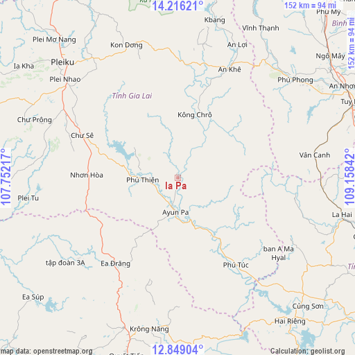
Ia Pa GPS coordinates[2]
13° 32' 0.996" North, 108° 27' 19.044" East
| Map corner | latitude | longitude |
|---|---|---|
| Upper-left | 14.21621°, | 107.75217° |
| Center: | 13.53361°, | 108.45529° |
| Lower-right: | 12.84904°, | 109.15842° |
| Map W x H: | 152×152 km | = 94.4×94.4mi |
| max Lat: | 23.27841° ⇑62.3% North |
| Ia Pa: | 13.53361° |
| min Lat: | ⇓37.7% South 8.65724° |
| min Long | Ia Pa | max Long |
| 102.4579° | 108.45529° | 112.72541° |
| W 91.4%⇐ | ⇒8.6% E |
Elevation
Elevation of Ia Pa is 191 m = 627 ft, and this is 61.5 m = 202 ft above average elevation for this country.
| Max E: |
1592 m = 5223 ft | 18.6% |
| Ia Pa | 191 m 627 ft | |
| Avg. | 129.5 m = 425 ft | |
Min E: |
-1 m = -3 ft | 81.4% |
See also: Vietnam elevation on elevation.city.
Geographical zone
Ia Pa is located in North Torrid zone (between Equator and Tropic of Cancer). Distance of this Northern Tropic circle is 1101.1 km =684.2 mi to North.| Distance of | km | miles | from Ia Pa |
|---|---|---|---|
| North Pole | 8502.3 | 5283.1 | to North |
| Arctic Circle | 5896.4 | 3663.9 | to North |
| Tropic Cancer | 1101.1 | 684.2 | to North |
| Equator | 1504.8 | 935 | to South |


Nearby cities:
15 places around Ia Pa: (largest is in red/bold)
• A Yun Pa
15 km =9.3 mi,  188°
188°
• Chư Prông
66.3 km =41.2 mi,  291°
291°
• Chư Sê
44.2 km =27.5 mi, 293°
• Ea Drăng
45.2 km =28.1 mi,  215°
215°
• K Bang
69.7 km =43.3 mi,  12°
12°
• Kon Dơng
60.4 km =37.5 mi,  338°
338°
• Krông Năng
65.8 km =40.9 mi, 190°
• Kông Chro
27.9 km =17.3 mi,  15°
15°
• La Hai
72.7 km =45.2 mi,  103°
103°
• Phú Phong
65.2 km =40.5 mi,  50°
50°
• Phú Túc
45.3 km =28.1 mi,  145°
145°
• Pleiku
70.1 km =43.6 mi,  315°
315°
• Vân Canh
59.4 km =36.9 mi,  80°
80°
• Vĩnh Thạnh
73.1 km =45.4 mi,  29°
29°
• Đăk Đoa
63.3 km =39.3 mi, 324°
Sources, notices
• [Note1] Compared only with cities in Vietnam existing in our database
• [Src1] Map data: © OpenStreetMap contributors (CC-BY-SA)
• [Src2] Other city data from geonames.org with taken over terms of usage.
• [Src3] Geographical zone / Annual Mean Temperature by Robert A. Rohde @ Wikipedia
