Ea Súp geodata
Ea Súp (Đắk Lắk) is a seat of a second-order administrative division; located in Vietnam in Asia/Ho_Chi_Minh (GMT+7) time zone. In our database, there are 94 cities with bigger population. Compared to other cities in Vietnam, 63.6% of cities are located further ↑North; 83.5% of cities are located further ←West and 82.5% of cities have lower elevation than Ea Súp. Note1


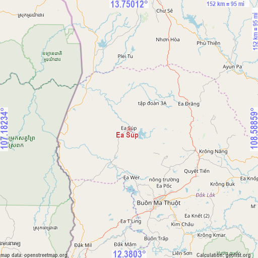
Ea Súp GPS coordinates[2]
13° 3' 58.176" North, 107° 53' 7.656" East
| Map corner | latitude | longitude |
|---|---|---|
| Upper-left | 13.75012°, | 107.18234° |
| Center: | 13.06616°, | 107.88546° |
| Lower-right: | 12.3803°, | 108.58859° |
| Map W x H: | 152.3×152.3 km | = 94.6×94.6mi |
| max Lat: | 23.27841° ⇑63.6% North |
| Ea Súp: | 13.06616° |
| min Lat: | ⇓36.4% South 8.65724° |
| min Long | Ea Súp | max Long |
| 102.4579° | 107.88546° | 112.72541° |
| W 83.5%⇐ | ⇒16.5% E |
Elevation
Elevation of Ea Súp is 208 m = 682 ft, and this is 78.5 m = 258 ft above average elevation for this country.
| Max E: |
1592 m = 5223 ft | 17.5% |
| Ea Súp | 208 m 682 ft | |
| Avg. | 129.5 m = 425 ft | |
Min E: |
-1 m = -3 ft | 82.5% |
See also: Vietnam elevation on elevation.city.
Geographical zone
Ea Súp is located in North Torrid zone (between Equator and Tropic of Cancer). Distance of this Northern Tropic circle is 1153.1 km =716.5 mi to North.| Distance of | km | miles | from Ea Súp |
|---|---|---|---|
| North Pole | 8554.2 | 5315.3 | to North |
| Arctic Circle | 5948.4 | 3696.2 | to North |
| Tropic Cancer | 1153.1 | 716.5 | to North |
| Equator | 1452.8 | 902.7 | to South |


Nearby cities:
15 places around Ea Súp: (largest is in red/bold)
• A Yun Pa
70.1 km =43.6 mi,  58°
58°
• Buôn Ma Thuột
47.3 km =29.4 mi,  159°
159°
• Buôn Trấp
66.5 km =41.3 mi,  166°
166°
• Chư Prông
76.8 km =47.7 mi,  0°
0°
• Chư Sê
72.7 km =45.2 mi,  16°
16°
• Ea Drăng
38.4 km =23.9 mi,  66°
66°
• Ea Kar
67.5 km =41.9 mi,  115°
115°
• Ea T’ling
53.1 km =33 mi,  178°
178°
• Krông Kmar
79.1 km =49.2 mi,  142°
142°
• Krông Năng
51.3 km =31.9 mi,  104°
104°
• Lắk
79.4 km =49.3 mi, 156°
• Phước An
59.8 km =37.2 mi,  131°
131°
• Quảng Phú
34.4 km =21.4 mi, 142°
• Tram de Dak Mil
74.3 km =46.2 mi,  202°
202°
• Đắk Mâm
67.7 km =42.1 mi, 182°
Sources, notices
• [Note1] Compared only with cities in Vietnam existing in our database
• [Src1] Map data: © OpenStreetMap contributors (CC-BY-SA)
• [Src2] Other city data from geonames.org with taken over terms of usage.
• [Src3] Geographical zone / Annual Mean Temperature by Robert A. Rohde @ Wikipedia
