Quảng Phú geodata
Quảng Phú (Đắk Lắk) is a seat of a second-order administrative division; located in Vietnam in Asia/Ho_Chi_Minh (GMT+7) time zone. In our database, there are 94 cities with bigger population. Compared to other cities in Vietnam, 64.3% of cities are located further ↑North; 85.3% of cities are located further ←West and 88.9% of cities have lower elevation than Quảng Phú. Note1


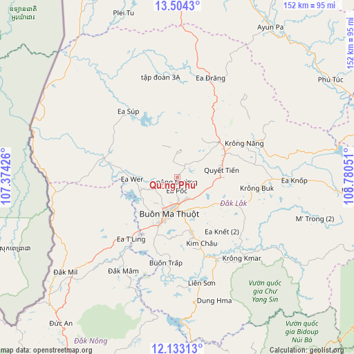
Quảng Phú GPS coordinates[2]
12° 49' 10.74" North, 108° 4' 38.568" East
| Map corner | latitude | longitude |
|---|---|---|
| Upper-left | 13.5043°, | 107.37426° |
| Center: | 12.81965°, | 108.07738° |
| Lower-right: | 12.13313°, | 108.78051° |
| Map W x H: | 152.5×152.5 km | = 94.8×94.8mi |
| max Lat: | 23.27841° ⇑64.3% North |
| Quảng Phú: | 12.81965° |
| min Lat: | ⇓35.7% South 8.65724° |
| min Long | Quảng Phú | max Long |
| 102.4579° | 108.07738° | 112.72541° |
| W 85.3%⇐ | ⇒14.7% E |
Elevation
Elevation of Quảng Phú is 462 m = 1516 ft, and this is 332.5 m = 1091 ft above average elevation for this country.
| Max E: |
1592 m = 5223 ft | 11.1% |
| Quảng Phú | 462 m 1516 ft | |
| Avg. | 129.5 m = 425 ft | |
Min E: |
-1 m = -3 ft | 88.9% |
See also: Vietnam elevation on elevation.city.
Geographical zone
Quảng Phú is located in North Torrid zone (between Equator and Tropic of Cancer). Distance of this Northern Tropic circle is 1180.5 km =733.5 mi to North.| Distance of | km | miles | from Quảng Phú |
|---|---|---|---|
| North Pole | 8581.7 | 5332.4 | to North |
| Arctic Circle | 5975.8 | 3713.2 | to North |
| Tropic Cancer | 1180.5 | 733.5 | to North |
| Equator | 1425.4 | 885.7 | to South |


Nearby cities:
15 places around Quảng Phú: (largest is in red/bold)
• A Yun Pa
75.3 km =46.8 mi,  30°
30°
• Buôn Ma Thuột
17.5 km =10.9 mi,  194°
194°
• Buôn Trấp
37.6 km =23.4 mi, 187°
• Ea Drăng
45.1 km =28 mi,  18°
18°
• Ea Kar
40.3 km =25 mi,  91°
91°
• Ea Súp
34.4 km =21.4 mi,  322°
322°
• Ea T’ling
32.3 km =20.1 mi,  217°
217°
• Krông Kmar
44.7 km =27.8 mi,  141°
141°
• Krông Năng
32.4 km =20.1 mi,  63°
63°
• Lắk
46.7 km =29 mi,  166°
166°
• M’Đrăk
72.6 km =45.1 mi,  96°
96°
• Phú Túc
78.5 km =48.8 mi, 57°
• Phước An
27 km =16.8 mi,  116°
116°
• Tram de Dak Mil
64.3 km =40 mi,  230°
230°
• Đắk Mâm
46.5 km =28.9 mi,  210°
210°
Sources, notices
• [Note1] Compared only with cities in Vietnam existing in our database
• [Src1] Map data: © OpenStreetMap contributors (CC-BY-SA)
• [Src2] Other city data from geonames.org with taken over terms of usage.
• [Src3] Geographical zone / Annual Mean Temperature by Robert A. Rohde @ Wikipedia
