Đông Thành geodata
Đông Thành (Long An) is a seat of a second-order administrative division; located in Vietnam in Asia/Ho_Chi_Minh (GMT+7) time zone. In our database, there are 94 cities with bigger population. Compared to other cities in Vietnam, 76.3% of cities are located further ↑North; 56.3% of cities are located further ←West and 92.5% of cities have higher elevation than Đông Thành. Note1


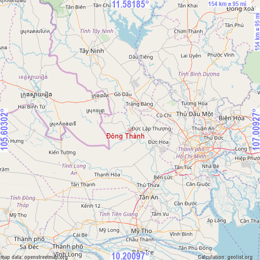
Đông Thành GPS coordinates[2]
10° 53' 31.956" North, 106° 18' 22.104" East
| Map corner | latitude | longitude |
|---|---|---|
| Upper-left | 11.58185°, | 105.60302° |
| Center: | 10.89221°, | 106.30614° |
| Lower-right: | 10.20097°, | 107.00927° |
| Map W x H: | 153.5×153.5 km | = 95.4×95.4mi |
| max Lat: | 23.27841° ⇑76.3% North |
| Đông Thành: | 10.89221° |
| min Lat: | ⇓23.7% South 8.65724° |
| min Long | Đông Thành | max Long |
| 102.4579° | 106.30614° | 112.72541° |
| W 56.3%⇐ | ⇒43.7% E |
Elevation
Elevation of Đông Thành is 4 m = 13 ft, and this is 125.5 m = 412 ft below average elevation for this country.
| Max E: |
1592 m = 5223 ft | 92.5% |
| Avg. | 129.5 m = 425 ft | |
| Đông Thành | 4 m = 13 ft | |
Min E: |
-1 m = -3 ft | 7.5% |
See also: Vietnam elevation on elevation.city.
Geographical zone
Đông Thành is located in North Torrid zone (between Equator and Tropic of Cancer). Distance of Equator is 1211.1 km =752.5 mi to South.| Distance of | km | miles | from Đông Thành |
|---|---|---|---|
| North Pole | 8796 | 5465.6 | to North |
| Arctic Circle | 6190.1 | 3846.3 | to North |
| Tropic Cancer | 1394.8 | 866.7 | to North |
| Equator | 1211.1 | 752.5 | to South |


Nearby cities:
15 places around Đông Thành: (largest is in red/bold)
• Bến Cầu
27.9 km =17.3 mi,  330°
330°
• Củ Chi
22.3 km =13.9 mi,  66°
66°
• Gò Dầu
22.3 km =13.9 mi,  347°
347°
• Ho Chi Minh City
36.2 km =22.5 mi,  102°
102°
• Hóc Môn
31.6 km =19.6 mi,  90°
90°
• Hậu Nghĩa
9.9 km =6.2 mi, 88°
• Quận Mười Một
39.5 km =24.5 mi,  111°
111°
• Quận Sáu
40.8 km =25.4 mi, 113°
• Quận Tân Phú
38.1 km =23.7 mi, 108°
• Thạnh Hóa
29.5 km =18.3 mi,  207°
207°
• Thủ Dầu Một
39 km =24.2 mi,  75°
75°
• Thủ Thừa
33.9 km =21.1 mi,  161°
161°
• Trảng Bàng
16.3 km =10.1 mi,  20°
20°
• Tân An
41.3 km =25.7 mi, 163°
• Tân Túc
38.1 km =23.7 mi,  125°
125°
Sources, notices
• [Note1] Compared only with cities in Vietnam existing in our database
• [Src1] Map data: © OpenStreetMap contributors (CC-BY-SA)
• [Src2] Other city data from geonames.org with taken over terms of usage.
• [Src3] Geographical zone / Annual Mean Temperature by Robert A. Rohde @ Wikipedia
