Thạnh Hóa geodata
Thạnh Hóa (Long An) is a seat of a second-order administrative division; located in Vietnam in Asia/Ho_Chi_Minh (GMT+7) time zone. In our database, there are 94 cities with bigger population. Compared to other cities in Vietnam, 81.2% of cities are located further ↑North; 52.7% of cities are located further ←West and 95.4% of cities have higher elevation than Thạnh Hóa. Note1


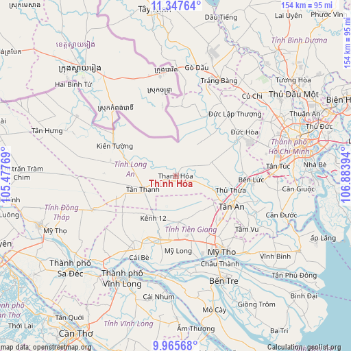
Thạnh Hóa GPS coordinates[2]
10° 39' 26.784" North, 106° 10' 50.916" East
| Map corner | latitude | longitude |
|---|---|---|
| Upper-left | 11.34764°, | 105.47769° |
| Center: | 10.65744°, | 106.18081° |
| Lower-right: | 9.96568°, | 106.88394° |
| Map W x H: | 153.7×153.7 km | = 95.5×95.5mi |
| max Lat: | 23.27841° ⇑81.2% North |
| Thạnh Hóa: | 10.65744° |
| min Lat: | ⇓18.8% South 8.65724° |
| min Long | Thạnh Hóa | max Long |
| 102.4579° | 106.18081° | 112.72541° |
| W 52.7%⇐ | ⇒47.3% E |
Elevation
Elevation of Thạnh Hóa is 3 m = 10 ft, and this is 126.5 m = 415 ft below average elevation for this country.
| Max E: |
1592 m = 5223 ft | 95.4% |
| Avg. | 129.5 m = 425 ft | |
| Thạnh Hóa | 3 m = 10 ft | |
Min E: |
-1 m = -3 ft | 4.6% |
See also: Vietnam elevation on elevation.city.
Geographical zone
Thạnh Hóa is located in North Torrid zone (between Equator and Tropic of Cancer). Distance of Equator is 1185 km =736.3 mi to South.| Distance of | km | miles | from Thạnh Hóa |
|---|---|---|---|
| North Pole | 8822.1 | 5481.8 | to North |
| Arctic Circle | 6216.2 | 3862.6 | to North |
| Tropic Cancer | 1420.9 | 882.9 | to North |
| Equator | 1185 | 736.3 | to South |


Nearby cities:
15 places around Thạnh Hóa: (largest is in red/bold)
• Châu Thành
44 km =27.3 mi,  154°
154°
• Chợ Gạo
46.1 km =28.6 mi,  137°
137°
• Chợ Lách
44.7 km =27.8 mi,  188°
188°
• Hậu Nghĩa
35.4 km =22 mi,  41°
41°
• Mỹ Phước
20.1 km =12.5 mi,  176°
176°
• Mỹ Tho
38.4 km =23.9 mi, 149°
• Thủ Thừa
24.9 km =15.5 mi,  104°
104°
• Trảng Bàng
45.7 km =28.4 mi,  24°
24°
• Tân An
28.8 km =17.9 mi,  117°
117°
• Tân Hiệp
29.2 km =18.1 mi, 142°
• Tân Thạnh
15.7 km =9.8 mi,  248°
248°
• Tân Trụ
39.2 km =24.4 mi,  114°
114°
• Tân Túc
45 km =28 mi,  84°
84°
• Tầm Vu
39.5 km =24.5 mi,  127°
127°
• Đông Thành
29.5 km =18.3 mi,  27°
27°
Sources, notices
• [Note1] Compared only with cities in Vietnam existing in our database
• [Src1] Map data: © OpenStreetMap contributors (CC-BY-SA)
• [Src2] Other city data from geonames.org with taken over terms of usage.
• [Src3] Geographical zone / Annual Mean Temperature by Robert A. Rohde @ Wikipedia
