Quận Bình Thạnh geodata
Quận Bình Thạnh (Ho Chi Minh) is a seat of a second-order administrative division; located in Vietnam in Asia/Ho_Chi_Minh (GMT+7) time zone. In our database, there are 94 cities with bigger population. Compared to other cities in Vietnam, 78% of cities are located further ↑North; 69.3% of cities are located further ←West and 50.4% of cities have higher elevation than Quận Bình Thạnh. Note1


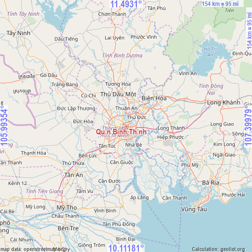
Quận Bình Thạnh GPS coordinates[2]
10° 48' 11.7" North, 106° 41' 47.976" East
| Map corner | latitude | longitude |
|---|---|---|
| Upper-left | 11.4931°, | 105.99354° |
| Center: | 10.80325°, | 106.69666° |
| Lower-right: | 10.11181°, | 107.39979° |
| Map W x H: | 153.6×153.6 km | = 95.4×95.4mi |
| max Lat: | 23.27841° ⇑78% North |
| Quận Bình Thạnh: | 10.80325° |
| min Lat: | ⇓22% South 8.65724° |
| min Long | Quận Bình Th | max Long |
| 102.4579° | 106.69666° | 112.72541° |
| W 69.3%⇐ | ⇒30.7% E |
Elevation
Elevation of Quận Bình Thạnh is 14 m = 46 ft, and this is 115.5 m = 379 ft below average elevation for this country.
| Max E: |
1592 m = 5223 ft | 50.4% |
| Avg. | 129.5 m = 425 ft | |
| Quận Bình Thạnh | 14 m = 46 ft | |
Min E: |
-1 m = -3 ft | 49.6% |
See also: Vietnam elevation on elevation.city.
Geographical zone
Quận Bình Thạnh is located in North Torrid zone (between Equator and Tropic of Cancer). Distance of Equator is 1201.2 km =746.4 mi to South.| Distance of | km | miles | from Quận Bình Thạnh |
|---|---|---|---|
| North Pole | 8805.9 | 5471.7 | to North |
| Arctic Circle | 6200 | 3852.5 | to North |
| Tropic Cancer | 1404.7 | 872.8 | to North |
| Equator | 1201.2 | 746.4 | to South |


Nearby cities:
15 places around Quận Bình Thạnh: (largest is in red/bold)
• Ho Chi Minh City
7.6 km =4.7 mi,  286°
286°
• Lái Thiêu
11.3 km =7 mi,  1°
1°
• Quận Ba
3.3 km =2.1 mi,  199°
199°
• Quận Bảy
11.1 km =6.9 mi,  156°
156°
• Quận Bốn
4.2 km =2.6 mi,  166°
166°
• Quận Chín
9.1 km =5.7 mi,  63°
63°
• Quận Hai
5.9 km =3.7 mi,  102°
102°
• Quận Mười
5.1 km =3.2 mi,  220°
220°
• Quận Mười Một
7.3 km =4.5 mi,  232°
232°
• Quận Một
2.5 km =1.6 mi, 173°
• Quận Năm
6.2 km =3.9 mi,  211°
211°
• Quận Phú Nhuận
2.4 km =1.5 mi,  246°
246°
• Quận Sáu
8.2 km =5.1 mi, 219°
• Quận Tân Phú
6.9 km =4.3 mi, 251°
• Thủ Đức
9.7 km =6 mi, 58°
Sources, notices
• [Note1] Compared only with cities in Vietnam existing in our database
• [Src1] Map data: © OpenStreetMap contributors (CC-BY-SA)
• [Src2] Other city data from geonames.org with taken over terms of usage.
• [Src3] Geographical zone / Annual Mean Temperature by Robert A. Rohde @ Wikipedia
