Thủ Đức geodata
Thủ Đức (Ho Chi Minh) is a seat of a second-order administrative division; located in Vietnam in Asia/Ho_Chi_Minh (GMT+7) time zone. In our database, there are 94 cities with bigger population. Compared to other cities in Vietnam, 77.2% of cities are located further ↑North; 71.6% of cities are located further ←West and 62.8% of cities have lower elevation than Thủ Đức. Note1


Thủ Đức GPS coordinates[2]
10° 50' 55.068" North, 106° 46' 19.524" East
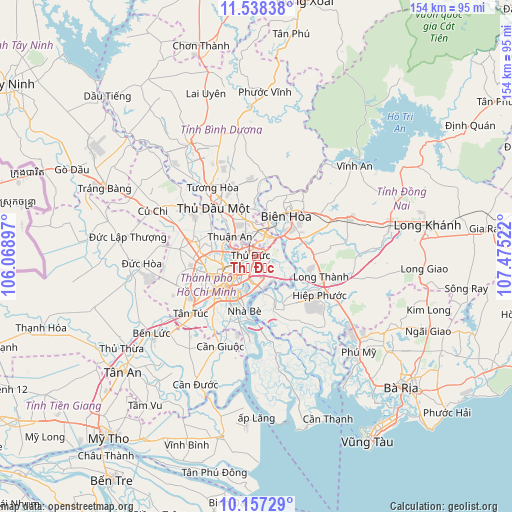
| Map corner | latitude | longitude |
|---|---|---|
| Upper-left | 11.53838°, | 106.06897° |
| Center: | 10.84863°, | 106.77209° |
| Lower-right: | 10.15729°, | 107.47522° |
| Map W x H: | 153.6×153.6 km | = 95.4×95.4mi |
| max Lat: | 23.27841° ⇑77.2% North |
| Thủ Đức: | 10.84863° |
| min Lat: | ⇓22.8% South 8.65724° |
| min Long | Thủ Đức | max Long |
| 102.4579° | 106.77209° | 112.72541° |
| W 71.6%⇐ | ⇒28.4% E |
Elevation
Elevation of Thủ Đức is 29 m = 95 ft, and this is 100.5 m = 330 ft below average elevation for this country.
| Max E: |
1592 m = 5223 ft | 37.2% |
| Avg. | 129.5 m = 425 ft | |
| Thủ Đức | 29 m = 95 ft | |
Min E: |
-1 m = -3 ft | 62.8% |
See also: Vietnam elevation on elevation.city.
Geographical zone
Thủ Đức is located in North Torrid zone (between Equator and Tropic of Cancer). Distance of Equator is 1206.3 km =749.6 mi to South.| Distance of | km | miles | from Thủ Đức |
|---|---|---|---|
| North Pole | 8800.8 | 5468.6 | to North |
| Arctic Circle | 6194.9 | 3849.3 | to North |
| Tropic Cancer | 1399.7 | 869.7 | to North |
| Equator | 1206.3 | 749.6 | to South |


Nearby cities:
15 places around Thủ Đức: (largest is in red/bold)
• Biên Hòa
12.1 km =7.5 mi,  28°
28°
• Dĩ An
6.5 km =4 mi,  357°
357°
• Ho Chi Minh City
15.8 km =9.8 mi,  259°
259°
• Lái Thiêu
10.1 km =6.3 mi,  308°
308°
• Quận Ba
12.4 km =7.7 mi,  228°
228°
• Quận Bình Thạnh
9.7 km =6 mi,  238°
238°
• Quận Bảy
15.7 km =9.8 mi,  194°
194°
• Quận Bốn
11.6 km =7.2 mi,  218°
218°
• Quận Chín
1 km =0.6 mi, 187°
• Quận Hai
6.8 km =4.2 mi,  201°
201°
• Quận Mười
14.6 km =9.1 mi, 232°
• Quận Một
11 km =6.8 mi, 226°
• Quận Năm
15.4 km =9.6 mi, 227°
• Quận Phú Nhuận
12.1 km =7.5 mi, 240°
• Quận Tân Phú
16.4 km =10.2 mi, 243°
Sources, notices
• [Note1] Compared only with cities in Vietnam existing in our database
• [Src1] Map data: © OpenStreetMap contributors (CC-BY-SA)
• [Src2] Other city data from geonames.org with taken over terms of usage.
• [Src3] Geographical zone / Annual Mean Temperature by Robert A. Rohde @ Wikipedia
