Vĩnh Châu geodata
Vĩnh Châu (Sóc Trăng) is a seat of a second-order administrative division; located in Vietnam in Asia/Ho_Chi_Minh (GMT+7) time zone. In our database, there are 94 cities with bigger population. Compared to other cities in Vietnam, 98% of cities are located further ↑North; 56.1% of cities are located further →East and 92.5% of cities have higher elevation than Vĩnh Châu. Note1


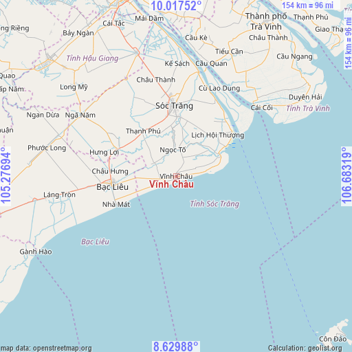
Vĩnh Châu GPS coordinates[2]
9° 19' 27.804" North, 105° 58' 48.216" East
| Map corner | latitude | longitude |
|---|---|---|
| Upper-left | 10.01752°, | 105.27694° |
| Center: | 9.32439°, | 105.98006° |
| Lower-right: | 8.62988°, | 106.68319° |
| Map W x H: | 154.3×154.3 km | = 95.9×95.9mi |
| max Lat: | 23.27841° ⇑98% North |
| Vĩnh Châu: | 9.32439° |
| min Lat: | ⇓2% South 8.65724° |
| min Long | Vĩnh Châu | max Long |
| 102.4579° | 105.98006° | 112.72541° |
| W 43.9%⇐ | ⇒56.1% E |
Elevation
Elevation of Vĩnh Châu is 4 m = 13 ft, and this is 125.5 m = 412 ft below average elevation for this country.
| Max E: |
1592 m = 5223 ft | 92.5% |
| Avg. | 129.5 m = 425 ft | |
| Vĩnh Châu | 4 m = 13 ft | |
Min E: |
-1 m = -3 ft | 7.5% |
See also: Vietnam elevation on elevation.city.
Geographical zone
Vĩnh Châu is located in North Torrid zone (between Equator and Tropic of Cancer). Distance of Equator is 1036.8 km =644.2 mi to South.| Distance of | km | miles | from Vĩnh Châu |
|---|---|---|---|
| North Pole | 8970.3 | 5573.9 | to North |
| Arctic Circle | 6364.4 | 3954.7 | to North |
| Tropic Cancer | 1569.1 | 975 | to North |
| Equator | 1036.8 | 644.2 | to South |


Nearby cities:
15 places around Vĩnh Châu: (largest is in red/bold)
• Bạc Liêu
27.9 km =17.3 mi,  263°
263°
• Châu Thành
42.7 km =26.5 mi,  348°
348°
• Cù Lao Dung
43 km =26.7 mi,  25°
25°
• Huỳnh Hữu Nghĩa
39.2 km =24.4 mi,  331°
331°
• Kế Sách
49.3 km =30.6 mi,  0°
0°
• Long Phú
35.2 km =21.9 mi, 25°
• Mỹ Xuyên
26.2 km =16.3 mi, 2°
• Ngã Bảy
57.1 km =35.5 mi,  342°
342°
• Phú Lộc
28.7 km =17.8 mi,  293°
293°
• Phụng Hiệp
57.4 km =35.7 mi, 331°
• Sóc Trăng
30.7 km =19.1 mi,  358°
358°
• Thị Trấn Giá Rai
58.4 km =36.3 mi, 260°
• Thị Trấn Hòa Bình
38.8 km =24.1 mi, 263°
• Thị Trấn Phước Long
58.2 km =36.2 mi,  282°
282°
• Trà Cú
51.5 km =32 mi,  36°
36°
Sources, notices
• [Note1] Compared only with cities in Vietnam existing in our database
• [Src1] Map data: © OpenStreetMap contributors (CC-BY-SA)
• [Src2] Other city data from geonames.org with taken over terms of usage.
• [Src3] Geographical zone / Annual Mean Temperature by Robert A. Rohde @ Wikipedia
