Ngã Bảy geodata
Ngã Bảy (Hậu Giang) is a seat of a second-order administrative division; located in Vietnam in Asia/Ho_Chi_Minh (GMT+7) time zone. In our database, there are 94 cities with bigger population. Compared to other cities in Vietnam, 94.3% of cities are located further ↑North; 63% of cities are located further →East and 100% of cities have higher elevation than Ngã Bảy. Note1


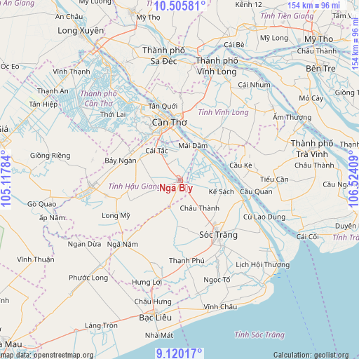
Ngã Bảy GPS coordinates[2]
9° 48' 49.356" North, 105° 49' 15.456" East
| Map corner | latitude | longitude |
|---|---|---|
| Upper-left | 10.50581°, | 105.11784° |
| Center: | 9.81371°, | 105.82096° |
| Lower-right: | 9.12017°, | 106.52409° |
| Map W x H: | 154.1×154.1 km | = 95.8×95.8mi |
| max Lat: | 23.27841° ⇑94.3% North |
| Ngã Bảy: | 9.81371° |
| min Lat: | ⇓5.7% South 8.65724° |
| min Long | Ngã Bảy | max Long |
| 102.4579° | 105.82096° | 112.72541° |
| W 37%⇐ | ⇒63% E |
Elevation
Elevation of Ngã Bảy is -1 m = -3 ft, and this is 130.5 m = 428 ft below average elevation for this country.
| Max E: |
1592 m = 5223 ft | 100% |
| Avg. | 129.5 m = 425 ft | |
| Ngã Bảy | -1 m = -3 ft | |
Min E: |
-1 m = -3 ft | 0% |
See also: Vietnam elevation on elevation.city.
Geographical zone
Ngã Bảy is located in North Torrid zone (between Equator and Tropic of Cancer). Distance of Equator is 1091.2 km =678 mi to South.| Distance of | km | miles | from Ngã Bảy |
|---|---|---|---|
| North Pole | 8915.9 | 5540.1 | to North |
| Arctic Circle | 6310 | 3920.9 | to North |
| Tropic Cancer | 1514.7 | 941.2 | to North |
| Equator | 1091.2 | 678 | to South |


Nearby cities:
15 places around Ngã Bảy: (largest is in red/bold)
• Bình Minh
28.3 km =17.6 mi,  0°
0°
• Bình Thủy
30.3 km =18.8 mi,  342°
342°
• Châu Thành
15.4 km =9.6 mi,  144°
144°
• Cái Răng
22.2 km =13.8 mi, 339°
• Cần Thơ
25.1 km =15.6 mi,  351°
351°
• Cầu Kè
26.5 km =16.5 mi,  75°
75°
• Huỳnh Hữu Nghĩa
19.9 km =12.4 mi,  182°
182°
• Kế Sách
18.8 km =11.7 mi,  105°
105°
• Long Mỹ
31 km =19.3 mi,  241°
241°
• Một Ngàn
24.3 km =15.1 mi,  300°
300°
• Ngã Sáu
12.3 km =7.6 mi, 352°
• Phong Điền
26.5 km =16.5 mi,  320°
320°
• Phụng Hiệp
10.3 km =6.4 mi,  248°
248°
• Sóc Trăng
29 km =18 mi,  145°
145°
• Trà Ôn
19.9 km =12.4 mi,  33°
33°
Sources, notices
• [Note1] Compared only with cities in Vietnam existing in our database
• [Src1] Map data: © OpenStreetMap contributors (CC-BY-SA)
• [Src2] Other city data from geonames.org with taken over terms of usage.
• [Src3] Geographical zone / Annual Mean Temperature by Robert A. Rohde @ Wikipedia
