Thị Trấn Trùng Khánh geodata
Thị Trấn Trùng Khánh (Cao Bằng) is a seat of a second-order administrative division; located in Vietnam in Asia/Ho_Chi_Minh (GMT+7) time zone. In our database, there are 94 cities with bigger population. Compared to other cities in Vietnam, 98.7% of cities are located further ↓South; 63.1% of cities are located further ←West and 91.2% of cities have lower elevation than Thị Trấn Trùng Khánh. Note1


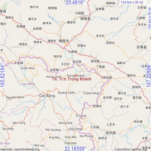
Thị Trấn Trùng Khánh GPS coordinates[2]
22° 50' 6.504" North, 106° 31' 29.856" East
| Map corner | latitude | longitude |
|---|---|---|
| Upper-left | 23.4816°, | 105.82184° |
| Center: | 22.83514°, | 106.52496° |
| Lower-right: | 22.18559°, | 107.22809° |
| Map W x H: | 144.1×144.1 km | = 89.5×89.5mi |
| max Lat: | 23.27841° ⇑1.3% North |
| Thị Trấn Trùng Khánh: | 22.83514° |
| min Lat: | ⇓98.7% South 8.65724° |
| min Long | Thị Trấn Tr | max Long |
| 102.4579° | 106.52496° | 112.72541° |
| W 63.1%⇐ | ⇒36.9% E |
Elevation
Elevation of Thị Trấn Trùng Khánh is 530 m = 1739 ft, and this is 400.5 m = 1314 ft above average elevation for this country.
| Max E: |
1592 m = 5223 ft | 8.8% |
| Thị Trấn Trùng Khánh | 530 m 1739 ft | |
| Avg. | 129.5 m = 425 ft | |
Min E: |
-1 m = -3 ft | 91.2% |
See also: Vietnam elevation on elevation.city.
Geographical zone
Thị Trấn Trùng Khánh is located in North Torrid zone (between Equator and Tropic of Cancer). Distance of this Northern Tropic circle is 66.9 km =41.6 mi to North.| Distance of | km | miles | from Thị Trấn Trùng Khánh |
|---|---|---|---|
| North Pole | 7468 | 4640.4 | to North |
| Arctic Circle | 4862.1 | 3021.2 | to North |
| Tropic Cancer | 66.9 | 41.6 | to North |
| Equator | 2539 | 1577.7 | to South |


Nearby cities:
15 places around Thị Trấn Trùng Khánh: (largest is in red/bold)
• Cao Bằng
33.2 km =20.6 mi,  235°
235°
• Thị Trấn Bảo Lạc
87.4 km =54.3 mi,  278°
278°
• Thị Trấn Hùng Quốc
20.7 km =12.9 mi,  268°
268°
• Thị Trấn Na Sầm
87.1 km =54.1 mi,  173°
173°
• Thị Trấn Nguyên Bình
61.5 km =38.2 mi,  250°
250°
• Thị Trấn Nước Hai
39.7 km =24.7 mi, 254°
• Thị Trấn Quảng Uyên
17.7 km =11 mi,  208°
208°
• Thị Trấn Thanh Nhật
22.2 km =13.8 mi,  137°
137°
• Thị Trấn Thông Nông
55.8 km =34.7 mi,  264°
264°
• Thị Trấn Thất Khê
64.7 km =40.2 mi,  184°
184°
• Thị Trấn Tà Lùng
37.7 km =23.4 mi, 173°
• Thị Trấn Xuân Hoà
46.5 km =28.9 mi, 279°
• Thị Trấn Đông Khê
46.1 km =28.6 mi,  191°
191°
• Vân Tùng
70.4 km =43.7 mi,  230°
230°
• Yến Lạc
75.3 km =46.8 mi, 207°
Sources, notices
• [Note1] Compared only with cities in Vietnam existing in our database
• [Src1] Map data: © OpenStreetMap contributors (CC-BY-SA)
• [Src2] Other city data from geonames.org with taken over terms of usage.
• [Src3] Geographical zone / Annual Mean Temperature by Robert A. Rohde @ Wikipedia
