Thị Trấn Na Sầm geodata
Thị Trấn Na Sầm (Lạng Sơn) is a seat of a second-order administrative division; located in Vietnam in Asia/Ho_Chi_Minh (GMT+7) time zone. In our database, there are 94 cities with bigger population. Compared to other cities in Vietnam, 90.9% of cities are located further ↓South; 66.2% of cities are located further ←West and 80.6% of cities have lower elevation than Thị Trấn Na Sầm. Note1


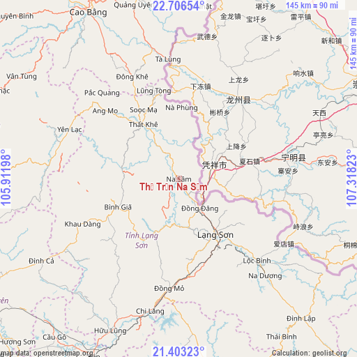
Thị Trấn Na Sầm GPS coordinates[2]
22° 3' 23.004" North, 106° 36' 54.36" East
| Map corner | latitude | longitude |
|---|---|---|
| Upper-left | 22.70654°, | 105.91198° |
| Center: | 22.05639°, | 106.6151° |
| Lower-right: | 21.40323°, | 107.31823° |
| Map W x H: | 144.9×144.9 km | = 90×90mi |
| max Lat: | 23.27841° ⇑9.1% North |
| Thị Trấn Na Sầm: | 22.05639° |
| min Lat: | ⇓90.9% South 8.65724° |
| min Long | Thị Trấn Na | max Long |
| 102.4579° | 106.6151° | 112.72541° |
| W 66.2%⇐ | ⇒33.8% E |
Elevation
Elevation of Thị Trấn Na Sầm is 179 m = 587 ft, and this is 49.5 m = 162 ft above average elevation for this country.
| Max E: |
1592 m = 5223 ft | 19.4% |
| Thị Trấn Na Sầm | 179 m 587 ft | |
| Avg. | 129.5 m = 425 ft | |
Min E: |
-1 m = -3 ft | 80.6% |
See also: Vietnam elevation on elevation.city.
Geographical zone
Thị Trấn Na Sầm is located in North Torrid zone (between Equator and Tropic of Cancer). Distance of this Northern Tropic circle is 153.5 km =95.4 mi to North.| Distance of | km | miles | from Thị Trấn Na Sầm |
|---|---|---|---|
| North Pole | 7554.6 | 4694.2 | to North |
| Arctic Circle | 4948.7 | 3075 | to North |
| Tropic Cancer | 153.5 | 95.4 | to North |
| Equator | 2452.4 | 1523.9 | to South |


Nearby cities:
15 places around Thị Trấn Na Sầm: (largest is in red/bold)
• Bình Gia
27.9 km =17.3 mi,  247°
247°
• Bắc Sơn
35 km =21.7 mi,  240°
240°
• Hữu Lũng
67.3 km =41.8 mi,  204°
204°
• Lạng Sơn
27.2 km =16.9 mi,  146°
146°
• Lộc Bình
45.9 km =28.5 mi,  136°
136°
• Thị Trấn Cao Lộc
26.4 km =16.4 mi, 143°
• Thị Trấn Quảng Uyên
73.2 km =45.5 mi,  345°
345°
• Thị Trấn Thanh Nhật
70.4 km =43.7 mi,  4°
4°
• Thị Trấn Thất Khê
26.5 km =16.5 mi,  326°
326°
• Thị Trấn Tà Lùng
49.3 km =30.6 mi, 354°
• Thị Trấn Đông Khê
45.6 km =28.3 mi,  335°
335°
• Văn Quan
22.7 km =14.1 mi, 200°
• Yến Lạc
49 km =30.4 mi,  294°
294°
• Đình Lập
75.5 km =46.9 mi, 138°
• Đồng Mỏ
44.6 km =27.7 mi,  184°
184°
Sources, notices
• [Note1] Compared only with cities in Vietnam existing in our database
• [Src1] Map data: © OpenStreetMap contributors (CC-BY-SA)
• [Src2] Other city data from geonames.org with taken over terms of usage.
• [Src3] Geographical zone / Annual Mean Temperature by Robert A. Rohde @ Wikipedia
