Al Jurbah geodata
Al Jurbah (Laḩij) is a seat of a second-order administrative division; located in Yemen in Asia/Aden (GMT+3) time zone. In our database, there are 51 cities with bigger population. Compared to other cities in Yemen, 83.1% of cities are located further ↑North; 68.8% of cities are located further ←West and 89% of cities have lower elevation than Al Jurbah. Note1


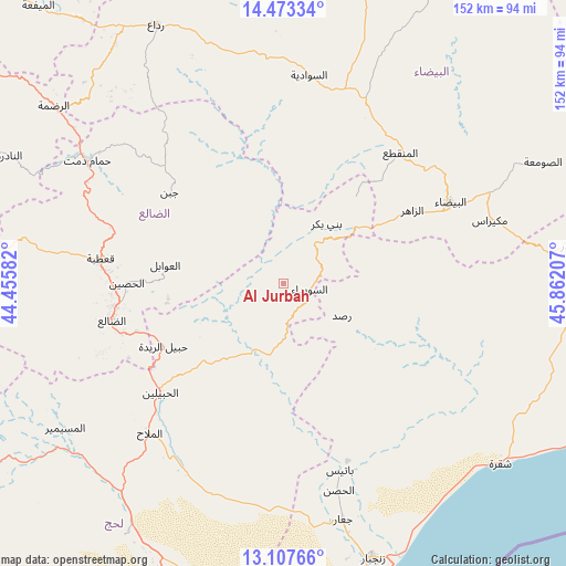
Al Jurbah GPS coordinates[2]
13° 47' 29.4" North, 45° 9' 32.184" East
| Map corner | latitude | longitude |
|---|---|---|
| Upper-left | 14.47334°, | 44.45582° |
| Center: | 13.7915°, | 45.15894° |
| Lower-right: | 13.10766°, | 45.86207° |
| Map W x H: | 151.8×151.9 km | = 94.3×94.4mi |
| max Lat: | 17.76999° ⇑83.1% North |
| Al Jurbah: | 13.7915° |
| min Lat: | ⇓16.9% South 12.18576° |
| min Long | Al Jurbah | max Long |
| 42.67107° | 45.15894° | 54.01895° |
| W 68.8%⇐ | ⇒31.2% E |
Elevation
Elevation of Al Jurbah is 2260 m = 7415 ft, and this is 955.2 m = 3134 ft above average elevation for this country.
| Max E: |
2791 m = 9157 ft | 11% |
| Al Jurbah | 2260 m 7415 ft | |
| Avg. | 1304.8 m = 4281 ft | |
Min E: |
4 m = 13 ft | 89% |
See also: Yemen elevation on elevation.city.
Geographical zone
Al Jurbah is located in North Torrid zone (between Equator and Tropic of Cancer). Distance of this Northern Tropic circle is 1072.4 km =666.4 mi to North.| Distance of | km | miles | from Al Jurbah |
|---|---|---|---|
| North Pole | 8473.6 | 5265.2 | to North |
| Arctic Circle | 5867.7 | 3646 | to North |
| Tropic Cancer | 1072.4 | 666.4 | to North |
| Equator | 1533.5 | 952.9 | to South |


Nearby cities:
15 places around Al Jurbah: (largest is in red/bold)
• Al Madu
37.5 km =23.3 mi,  281°
281°
• Al Ḩabīlayn
44.9 km =27.9 mi,  227°
227°
• Al Ḩusayn
42.1 km =26.2 mi,  270°
270°
• Al ‘Awābil
32.2 km =20 mi, 279°
• As Suwaydā
7.7 km =4.8 mi,  93°
93°
• Az Zāhir
40.1 km =24.9 mi,  60°
60°
• Banī Bakr
19.6 km =12.2 mi,  36°
36°
• Dhī Nā‘im
46.8 km =29.1 mi, 41°
• Juban
39.3 km =24.4 mi,  308°
308°
• Madīnat Lab‘ūs
12.9 km =8 mi,  49°
49°
• Raşad
17.9 km =11.1 mi,  119°
119°
• Sirār
23.9 km =14.9 mi,  135°
135°
• Sūq Sibāḩ
25.3 km =15.7 mi,  84°
84°
• Ḩabīl al Jabr
28 km =17.4 mi,  221°
221°
• Ḩabīl ar Raydah
37.1 km =23.1 mi,  243°
243°
Sources, notices
• [Note1] Compared only with cities in Yemen existing in our database
• [Src1] Map data: © OpenStreetMap contributors (CC-BY-SA)
• [Src2] Other city data from geonames.org with taken over terms of usage.
• [Src3] Geographical zone / Annual Mean Temperature by Robert A. Rohde @ Wikipedia
