Ḩabīl al Jabr geodata
Ḩabīl al Jabr (Laḩij) is a seat of a second-order administrative division; located in Yemen in Asia/Aden (GMT+3) time zone. In our database, there are 51 cities with bigger population. Compared to other cities in Yemen, 87.7% of cities are located further ↑North; 65.3% of cities are located further ←West and 73.4% of cities have higher elevation than Ḩabīl al Jabr. Note1


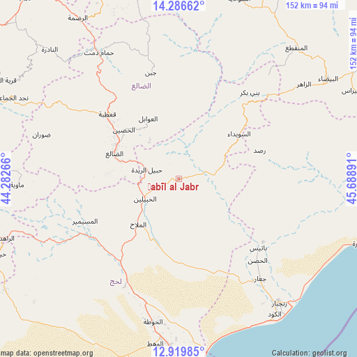
Ḩabīl al Jabr GPS coordinates[2]
13° 36' 15.192" North, 44° 59' 8.808" East
| Map corner | latitude | longitude |
|---|---|---|
| Upper-left | 14.28662°, | 44.28266° |
| Center: | 13.60422°, | 44.98578° |
| Lower-right: | 12.91985°, | 45.68891° |
| Map W x H: | 152×152 km | = 94.4×94.4mi |
| max Lat: | 17.76999° ⇑87.7% North |
| Ḩabīl al Jabr: | 13.60422° |
| min Lat: | ⇓12.3% South 12.18576° |
| min Long | Ḩabīl al Jab | max Long |
| 42.67107° | 44.98578° | 54.01895° |
| W 65.3%⇐ | ⇒34.7% E |
Elevation
Elevation of Ḩabīl al Jabr is 697 m = 2287 ft, and this is 607.8 m = 1994 ft below average elevation for this country.
| Max E: |
2791 m = 9157 ft | 73.4% |
| Avg. | 1304.8 m = 4281 ft | |
| Ḩabīl al Jabr | 697 m = 2287 ft | |
Min E: |
4 m = 13 ft | 26.6% |
See also: Yemen elevation on elevation.city.
Geographical zone
Ḩabīl al Jabr is located in North Torrid zone (between Equator and Tropic of Cancer). Distance of this Northern Tropic circle is 1093.3 km =679.3 mi to North.| Distance of | km | miles | from Ḩabīl al Jabr |
|---|---|---|---|
| North Pole | 8494.4 | 5278.2 | to North |
| Arctic Circle | 5888.5 | 3658.9 | to North |
| Tropic Cancer | 1093.3 | 679.3 | to North |
| Equator | 1512.6 | 939.9 | to South |


Nearby cities:
15 places around Ḩabīl al Jabr: (largest is in red/bold)
• Al Jurbah
28 km =17.4 mi,  41°
41°
• Al Madu
33.4 km =20.8 mi,  327°
327°
• Al Milāḩ
26.3 km =16.3 mi,  221°
221°
• Al Musaymīr
43.8 km =27.2 mi,  246°
246°
• Al Ḩabīlayn
17.3 km =10.7 mi,  237°
237°
• Al Ḩusayn
31.4 km =19.5 mi,  311°
311°
• Al ‘Awābil
29.1 km =18.1 mi, 333°
• As Suwaydā
33.3 km =20.7 mi,  52°
52°
• Dhalie
29.3 km =18.2 mi,  290°
290°
• Dhī Jalāl
30.1 km =18.7 mi,  274°
274°
• Madīnat Lab‘ūs
40.8 km =25.4 mi, 44°
• Qa‘ţabah
41.1 km =25.5 mi, 312°
• Raşad
36.3 km =22.6 mi,  70°
70°
• Sirār
35.6 km =22.1 mi,  83°
83°
• Ḩabīl ar Raydah
15.2 km =9.4 mi, 287°
Sources, notices
• [Note1] Compared only with cities in Yemen existing in our database
• [Src1] Map data: © OpenStreetMap contributors (CC-BY-SA)
• [Src2] Other city data from geonames.org with taken over terms of usage.
• [Src3] Geographical zone / Annual Mean Temperature by Robert A. Rohde @ Wikipedia
