Al Madu geodata
Al Madu (Aḑ Ḑāli‘) is a populated place; located in Yemen in Asia/Aden (GMT+3) time zone. With population of 1,986 people, there are 34 cities with bigger population in this country. Compared to other cities in Yemen, 80.2% of cities are located further ↑North; 61% of cities are located further ←West and 73.1% of cities have lower elevation than Al Madu. Note1


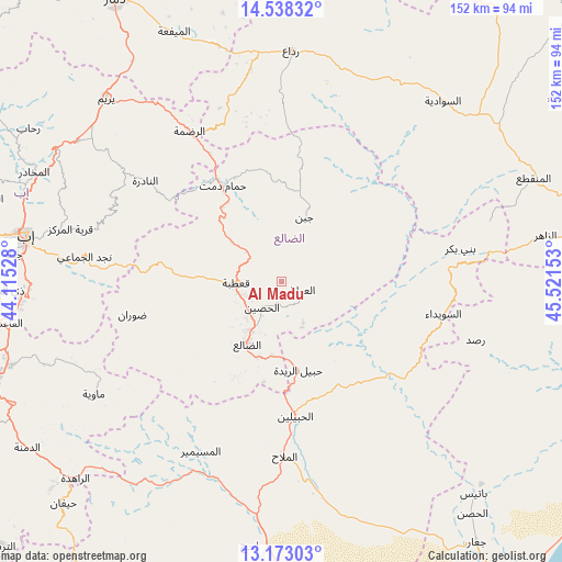
Al Madu GPS coordinates[2]
13° 51' 24.048" North, 44° 49' 6.24" East
| Map corner | latitude | longitude |
|---|---|---|
| Upper-left | 14.53832°, | 44.11528° |
| Center: | 13.85668°, | 44.8184° |
| Lower-right: | 13.17303°, | 45.52153° |
| Map W x H: | 151.8×151.8 km | = 94.3×94.3mi |
| max Lat: | 17.76999° ⇑80.2% North |
| Al Madu: | 13.85668° |
| min Lat: | ⇓19.8% South 12.18576° |
| min Long | Al Madu | max Long |
| 42.67107° | 44.8184° | 54.01895° |
| W 61%⇐ | ⇒39% E |
Elevation
Elevation of Al Madu is 1999 m = 6558 ft, and this is 694.2 m = 2278 ft above average elevation for this country.
| Max E: |
2791 m = 9157 ft | 26.9% |
| Al Madu | 1999 m 6558 ft | |
| Avg. | 1304.8 m = 4281 ft | |
Min E: |
4 m = 13 ft | 73.1% |
See also: Yemen elevation on elevation.city.
Geographical zone
Al Madu is located in North Torrid zone (between Equator and Tropic of Cancer). Distance of this Northern Tropic circle is 1065.2 km =661.9 mi to North.| Distance of | km | miles | from Al Madu |
|---|---|---|---|
| North Pole | 8466.3 | 5260.7 | to North |
| Arctic Circle | 5860.5 | 3641.5 | to North |
| Tropic Cancer | 1065.2 | 661.9 | to North |
| Equator | 1540.7 | 957.3 | to South |


Nearby cities:
15 places around Al Madu: (largest is in red/bold)
• Al Jurbah
37.5 km =23.3 mi,  101°
101°
• Al Ḩabīlayn
37.6 km =23.4 mi,  174°
174°
• Al Ḩusayn
9 km =5.6 mi,  216°
216°
• Al ‘Aqabah
46.3 km =28.8 mi,  355°
355°
• Al ‘Awābil
5.4 km =3.4 mi,  113°
113°
• An Nādirah
45.6 km =28.3 mi,  305°
305°
• As Suwaydā
45.2 km =28.1 mi, 99°
• Dhalie
20.2 km =12.6 mi,  207°
207°
• Dhī Jalāl
28.5 km =17.7 mi,  204°
204°
• Juban
18.3 km =11.4 mi,  19°
19°
• Qa‘ţabah
12.2 km =7.6 mi,  269°
269°
• Ḑawrān
41.7 km =25.9 mi,  257°
257°
• Ḩabīl al Jabr
33.4 km =20.8 mi,  147°
147°
• Ḩabīl ar Raydah
23.9 km =14.9 mi, 171°
• Ḩammām Damt
30.5 km =19 mi,  328°
328°
Sources, notices
• [Note1] Compared only with cities in Yemen existing in our database
• [Src1] Map data: © OpenStreetMap contributors (CC-BY-SA)
• [Src2] Other city data from geonames.org with taken over terms of usage.
• [Src3] Geographical zone / Annual Mean Temperature by Robert A. Rohde @ Wikipedia
