Ōmnah geodata
Ōmnah (Paktika) is a seat of a second-order administrative division; located in Afghanistan in Asia/Kabul (GMT+4.5) time zone. In our database, there are 93 cities with bigger population. Compared to other cities in Afghanistan, 83.6% of cities are located further ↑North; 54.7% of cities are located further ←West and 96.1% of cities have lower elevation than Ōmnah. Note1


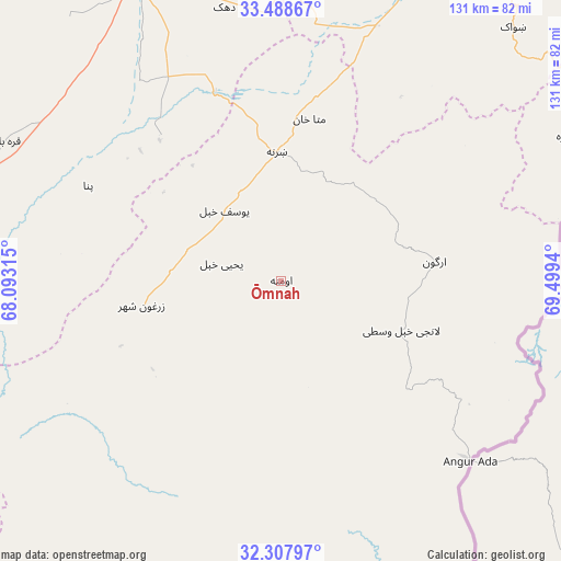
Ōmnah GPS coordinates[2]
32° 54' 1.044" North, 68° 47' 46.572" East
| Map corner | latitude | longitude |
|---|---|---|
| Upper-left | 33.48867°, | 68.09315° |
| Center: | 32.90029°, | 68.79627° |
| Lower-right: | 32.30797°, | 69.4994° |
| Map W x H: | 131.3×131.3 km | = 81.6×81.6mi |
| max Lat: | 38.4435° ⇑83.6% North |
| Ōmnah: | 32.90029° |
| min Lat: | ⇓16.4% South 30.15° |
| min Long | Ōmnah | max Long |
| 61.06667° | 68.79627° | 72.318° |
| W 54.7%⇐ | ⇒45.3% E |
Elevation
Elevation of Ōmnah is 2595 m = 8514 ft, and this is 1176.6 m = 3860 ft above average elevation for this country.
| Max E: |
3068 m = 10066 ft | 3.9% |
| Ōmnah | 2595 m 8514 ft | |
| Avg. | 1418.4 m = 4654 ft | |
Min E: |
254 m = 833 ft | 96.1% |
See also: Afghanistan elevation on elevation.city.
Geographical zone
Ōmnah is located in North temperate zone (between Tropic of Cancer and the Arctic Circle). Distance of this Northern Tropic circle is 1052.3 km =653.9 mi to South.| Distance of | km | miles | from Ōmnah |
|---|---|---|---|
| North Pole | 6348.9 | 3945 | to North |
| Arctic Circle | 3743 | 2325.8 | to North |
| Tropic Cancer | 1052.3 | 653.9 | to South |
| Equator | 3658.2 | 2273.1 | to South |


Nearby cities:
15 places around Ōmnah: (largest is in red/bold)
• Gōmal Kêlay
43.8 km =27.2 mi,  172°
172°
• Jānī Khēl
40.3 km =25 mi,  247°
247°
• Khayr Kōṯ
32.8 km =20.4 mi,  260°
260°
• Khōshāmand
57.4 km =35.7 mi, 245°
• Mutā Khān
38.3 km =23.8 mi,  9°
9°
• Nīkêh
54.7 km =34 mi,  54°
54°
• Sharan
31.2 km =19.4 mi,  348°
348°
• Stêr Giyān
54.5 km =33.9 mi,  80°
80°
• Urgun
36.5 km =22.7 mi, 81°
• Yaḩyá Khēl
14.6 km =9.1 mi,  286°
286°
• Zarghūn Shahr
33.3 km =20.7 mi, 259°
• Zaṟah Sharan
27.4 km =17 mi,  359°
359°
• Zerok-Alakadari
56 km =34.8 mi,  59°
59°
• ‘Alāqahdārī Saṟōbī
29.6 km =18.4 mi,  113°
113°
• ‘Alāqahdārī Yōsuf Khēl
21.7 km =13.5 mi,  321°
321°
Sources, notices
• [Note1] Compared only with cities in Afghanistan existing in our database
• [Src1] Map data: © OpenStreetMap contributors (CC-BY-SA)
• [Src2] Other city data from geonames.org with taken over terms of usage.
• [Src3] Geographical zone / Annual Mean Temperature by Robert A. Rohde @ Wikipedia
