Shaghat geodata
Shaghat (Syunik) is a populated place; located in Armenia in Asia/Yerevan (GMT+4) time zone. With population of 1,011 people, there are 307 cities with bigger population in this country. Compared to other cities in Armenia, 96.2% of cities are located further ↑North; 95.5% of cities are located further ←West and 81.2% of cities have lower elevation than Shaghat. Note1


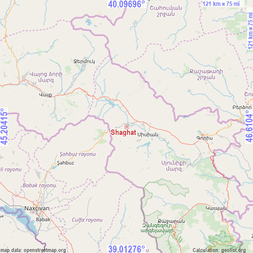
Shaghat GPS coordinates[2]
39° 33' 25.128" North, 45° 54' 26.172" East
| Map corner | latitude | longitude |
|---|---|---|
| Upper-left | 40.09696°, | 45.20415° |
| Center: | 39.55698°, | 45.90727° |
| Lower-right: | 39.01276°, | 46.6104° |
| Map W x H: | 120.6×120.6 km | = 74.9×74.9mi |
| max Lat: | 41.24358° ⇑96.2% North |
| Shaghat: | 39.55698° |
| min Lat: | ⇓3.8% South 38.90292° |
| min Long | Shaghat | max Long |
| 43.74722° | 45.90727° | 46.5446° |
| W 95.5%⇐ | ⇒4.5% E |
Elevation
Elevation of Shaghat is 1790 m = 5873 ft, and this is 488.5 m = 1603 ft above average elevation for this country.
| Max E: |
2169 m = 7116 ft | 18.8% |
| Shaghat | 1790 m 5873 ft | |
| Avg. | 1301.5 m = 4270 ft | |
Min E: |
440 m = 1444 ft | 81.2% |
See also: Armenia elevation on elevation.city.
Geographical zone
Shaghat is located in North temperate zone (between Tropic of Cancer and the Arctic Circle). Distance of this Northern Tropic circle is 1792.4 km =1113.7 mi to South.| Distance of | km | miles | from Shaghat |
|---|---|---|---|
| North Pole | 5608.7 | 3485.1 | to North |
| Arctic Circle | 3002.9 | 1865.9 | to North |
| Tropic Cancer | 1792.4 | 1113.7 | to South |
| Equator | 4398.3 | 2733 | to South |


Nearby cities:
15 places around Shaghat: (largest is in red/bold)
• Akner
34.4 km =21.4 mi,  94°
94°
• Angeghakot’
3.5 km =2.2 mi,  66°
66°
• Brrnakot’
8.7 km =5.4 mi,  139°
139°
• Gorayk’
18.7 km =11.6 mi,  318°
318°
• Goris
37.6 km =23.4 mi,  97°
97°
• Hats’avan
11.7 km =7.3 mi,  152°
152°
• Jermuk
37.6 km =23.4 mi,  327°
327°
• Khndzoresk
45.7 km =28.4 mi, 97°
• Malishka
47.9 km =29.8 mi,  296°
296°
• Shinuhayr
37.7 km =23.4 mi,  110°
110°
• Tat’ev
34.6 km =21.5 mi,  123°
123°
• Tegh
49.1 km =30.5 mi, 89°
• Vayk’
40.5 km =25.2 mi,  291°
291°
• Verishen
35.5 km =22.1 mi, 93°
• Zarrit’ap’
35.1 km =21.8 mi, 285°
Sources, notices
• [Note1] Compared only with cities in Armenia existing in our database
• [Src1] Map data: © OpenStreetMap contributors (CC-BY-SA)
• [Src2] Other city data from geonames.org with taken over terms of usage.
• [Src3] Geographical zone / Annual Mean Temperature by Robert A. Rohde @ Wikipedia
