Khndzoresk geodata
Khndzoresk (Syunik) is a populated place; located in Armenia in Asia/Yerevan (GMT+4) time zone. With population of 1,940 people, there are 163 cities with bigger population in this country. Compared to other cities in Armenia, 97.5% of cities are located further ↑North; 99.4% of cities are located further ←West and 56.1% of cities have lower elevation than Khndzoresk. Note1


Khndzoresk GPS coordinates[2]
39° 30' 20.448" North, 46° 26' 9.96" East
| Map corner | latitude | longitude |
|---|---|---|
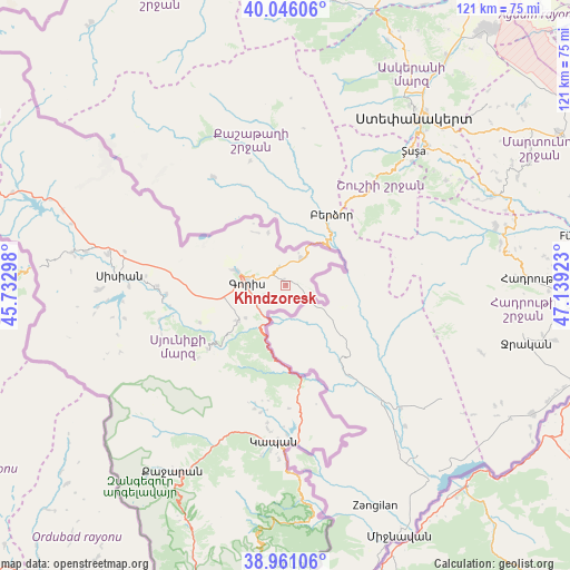
| Upper-left | 40.04606°, | 45.73298° |
| Center: | 39.50568°, | 46.4361° |
| Lower-right: | 38.96106°, | 47.13923° |
| Map W x H: | 120.6×120.6 km | = 74.9×74.9mi |
| max Lat: | 41.24358° ⇑97.5% North |
| Khndzoresk: | 39.50568° |
| min Lat: | ⇓2.5% South 38.90292° |
| min Long | Khndzoresk | max Long |
| 43.74722° | 46.4361° | 46.5446° |
| W 99.4%⇐ | ⇒0.59999999999999% E |
Elevation
Elevation of Khndzoresk is 1408 m = 4619 ft, and this is 106.5 m = 349 ft above average elevation for this country.
| Max E: |
2169 m = 7116 ft | 43.9% |
| Khndzoresk | 1408 m 4619 ft | |
| Avg. | 1301.5 m = 4270 ft | |
Min E: |
440 m = 1444 ft | 56.1% |
See also: Armenia elevation on elevation.city.
Geographical zone
Khndzoresk is located in North temperate zone (between Tropic of Cancer and the Arctic Circle). Distance of this Northern Tropic circle is 1786.7 km =1110.2 mi to South.| Distance of | km | miles | from Khndzoresk |
|---|---|---|---|
| North Pole | 5614.4 | 3488.6 | to North |
| Arctic Circle | 3008.6 | 1869.5 | to North |
| Tropic Cancer | 1786.7 | 1110.2 | to South |
| Equator | 4392.6 | 2729.4 | to South |


Nearby cities:
15 places around Khndzoresk: (largest is in red/bold)
• Agarak
34.5 km =21.4 mi,  164°
164°
• Akner
11.5 km =7.1 mi,  286°
286°
• Angeghakot’
42.7 km =26.5 mi,  279°
279°
• Brrnakot’
39.8 km =24.7 mi,  268°
268°
• Dzorastan
27 km =16.8 mi,  194°
194°
• Gorayk’
61 km =37.9 mi, 288°
• Goris
8.1 km =5 mi, 274°
• Hats’avan
40.2 km =25 mi,  263°
263°
• Kapan
33.3 km =20.7 mi,  184°
184°
• Meghri
69 km =42.9 mi, 193°
• Shaghat
45.7 km =28.4 mi, 277°
• Shinuhayr
12.7 km =7.9 mi,  232°
232°
• Tat’ev
21.2 km =13.2 mi, 231°
• Tegh
7 km =4.3 mi,  33°
33°
• Verishen
10.4 km =6.5 mi, 288°
Sources, notices
• [Note1] Compared only with cities in Armenia existing in our database
• [Src1] Map data: © OpenStreetMap contributors (CC-BY-SA)
• [Src2] Other city data from geonames.org with taken over terms of usage.
• [Src3] Geographical zone / Annual Mean Temperature by Robert A. Rohde @ Wikipedia
