Malishka geodata
Malishka (Vayots Dzor) is a populated place; located in Armenia in Asia/Yerevan (GMT+4) time zone. With population of 4,174 people, there are 60 cities with bigger population in this country. Compared to other cities in Armenia, 93.6% of cities are located further ↑North; 90.8% of cities are located further ←West and 51.3% of cities have higher elevation than Malishka. Note1


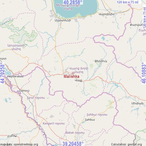
Malishka GPS coordinates[2]
39° 44' 50.316" North, 45° 24' 20.52" East
| Map corner | latitude | longitude |
|---|---|---|
| Upper-left | 40.2858°, | 44.70258° |
| Center: | 39.74731°, | 45.4057° |
| Lower-right: | 39.20458°, | 46.10883° |
| Map W x H: | 120.2×120.2 km | = 74.7×74.7mi |
| max Lat: | 41.24358° ⇑93.6% North |
| Malishka: | 39.74731° |
| min Lat: | ⇓6.4% South 38.90292° |
| min Long | Malishka | max Long |
| 43.74722° | 45.4057° | 46.5446° |
| W 90.8%⇐ | ⇒9.2% E |
Elevation
Elevation of Malishka is 1260 m = 4134 ft, and this is 41.5 m = 136 ft below average elevation for this country.
| Max E: |
2169 m = 7116 ft | 51.3% |
| Avg. | 1301.5 m = 4270 ft | |
| Malishka | 1260 m = 4134 ft | |
Min E: |
440 m = 1444 ft | 48.7% |
See also: Armenia elevation on elevation.city.
Geographical zone
Malishka is located in North temperate zone (between Tropic of Cancer and the Arctic Circle). Distance of this Northern Tropic circle is 1813.6 km =1126.9 mi to South.| Distance of | km | miles | from Malishka |
|---|---|---|---|
| North Pole | 5587.6 | 3472 | to North |
| Arctic Circle | 2981.7 | 1852.7 | to North |
| Tropic Cancer | 1813.6 | 1126.9 | to South |
| Equator | 4419.5 | 2746.1 | to South |


Nearby cities:
15 places around Malishka: (largest is in red/bold)
• Agarakadzor
4.5 km =2.8 mi,  253°
253°
• Aghavnadzor
15.8 km =9.8 mi,  285°
285°
• Areni
19.3 km =12 mi,  259°
259°
• Getap’
8.5 km =5.3 mi,  282°
282°
• Gladzor
6.2 km =3.9 mi,  306°
306°
• Gorayk’
31.3 km =19.4 mi,  103°
103°
• Jermuk
24.9 km =15.5 mi,  65°
65°
• Rrind
19.5 km =12.1 mi,  274°
274°
• Shatin
13.2 km =8.2 mi,  318°
318°
• Vayk’
8.3 km =5.2 mi,  141°
141°
• Vernashen
6.2 km =3.9 mi, 324°
• Yeghegis
14.7 km =9.1 mi,  341°
341°
• Yeghegnadzor
6.5 km =4 mi, 286°
• Zangakatun
32.2 km =20 mi, 285°
• Zarrit’ap’
15.1 km =9.4 mi, 143°
Sources, notices
• [Note1] Compared only with cities in Armenia existing in our database
• [Src1] Map data: © OpenStreetMap contributors (CC-BY-SA)
• [Src2] Other city data from geonames.org with taken over terms of usage.
• [Src3] Geographical zone / Annual Mean Temperature by Robert A. Rohde @ Wikipedia
