Zarrit’ap’ geodata
Zarrit’ap’ (Vayots Dzor) is a populated place; located in Armenia in Asia/Yerevan (GMT+4) time zone. With population of 1,323 people, there are 246 cities with bigger population in this country. Compared to other cities in Armenia, 95.2% of cities are located further ↑North; 92.7% of cities are located further ←West and 64.3% of cities have lower elevation than Zarrit’ap’. Note1


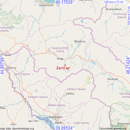
Zarrit’ap’ GPS coordinates[2]
39° 38' 20.112" North, 45° 30' 39.996" East
| Map corner | latitude | longitude |
|---|---|---|
| Upper-left | 40.17826°, | 44.80799° |
| Center: | 39.63892°, | 45.51111° |
| Lower-right: | 39.09534°, | 46.21424° |
| Map W x H: | 120.4×120.4 km | = 74.8×74.8mi |
| max Lat: | 41.24358° ⇑95.2% North |
| Zarrit’ap’: | 39.63892° |
| min Lat: | ⇓4.8% South 38.90292° |
| min Long | Zarrit’ap’ | max Long |
| 43.74722° | 45.51111° | 46.5446° |
| W 92.7%⇐ | ⇒7.3% E |
Elevation
Elevation of Zarrit’ap’ is 1512 m = 4961 ft, and this is 210.5 m = 691 ft above average elevation for this country.
| Max E: |
2169 m = 7116 ft | 35.7% |
| Zarrit’ap’ | 1512 m 4961 ft | |
| Avg. | 1301.5 m = 4270 ft | |
Min E: |
440 m = 1444 ft | 64.3% |
See also: Armenia elevation on elevation.city.
Geographical zone
Zarrit’ap’ is located in North temperate zone (between Tropic of Cancer and the Arctic Circle). Distance of this Northern Tropic circle is 1801.5 km =1119.4 mi to South.| Distance of | km | miles | from Zarrit’ap’ |
|---|---|---|---|
| North Pole | 5599.6 | 3479.4 | to North |
| Arctic Circle | 2993.7 | 1860.2 | to North |
| Tropic Cancer | 1801.5 | 1119.4 | to South |
| Equator | 4407.4 | 2738.6 | to South |


Nearby cities:
15 places around Zarrit’ap’: (largest is in red/bold)
• Agarakadzor
17.1 km =10.6 mi,  309°
309°
• Aghavnadzor
29.2 km =18.1 mi,  304°
304°
• Areni
29.4 km =18.3 mi,  287°
287°
• Getap’
22.2 km =13.8 mi, 308°
• Gladzor
21.1 km =13.1 mi,  318°
318°
• Gorayk’
22 km =13.7 mi,  77°
77°
• Jermuk
26.3 km =16.3 mi,  30°
30°
• Malishka
15.1 km =9.4 mi, 323°
• Rrind
31.6 km =19.6 mi, 295°
• Shaghat
35.1 km =21.8 mi,  105°
105°
• Shatin
28.2 km =17.5 mi, 320°
• Vayk’
6.7 km =4.2 mi,  325°
325°
• Vernashen
21.2 km =13.2 mi, 323°
• Yeghegis
29.4 km =18.3 mi, 332°
• Yeghegnadzor
20.7 km =12.9 mi, 312°
Sources, notices
• [Note1] Compared only with cities in Armenia existing in our database
• [Src1] Map data: © OpenStreetMap contributors (CC-BY-SA)
• [Src2] Other city data from geonames.org with taken over terms of usage.
• [Src3] Geographical zone / Annual Mean Temperature by Robert A. Rohde @ Wikipedia
