Hovtamej geodata
Hovtamej (Armavir) is a populated place; located in Armenia in Asia/Yerevan (GMT+4) time zone. With population of 1,018 people, there are 305 cities with bigger population in this country. Compared to other cities in Armenia, 52.9% of cities are located further ↑North; 76.1% of cities are located further →East and 69.1% of cities have higher elevation than Hovtamej. Note1


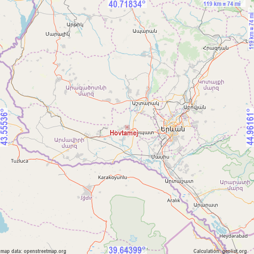
Hovtamej GPS coordinates[2]
40° 10' 59.844" North, 44° 15' 30.528" East
| Map corner | latitude | longitude |
|---|---|---|
| Upper-left | 40.71834°, | 43.55536° |
| Center: | 40.18329°, | 44.25848° |
| Lower-right: | 39.64399°, | 44.96161° |
| Map W x H: | 119.5×119.5 km | = 74.3×74.3mi |
| max Lat: | 41.24358° ⇑52.9% North |
| Hovtamej: | 40.18329° |
| min Lat: | ⇓47.1% South 38.90292° |
| min Long | Hovtamej | max Long |
| 43.74722° | 44.25848° | 46.5446° |
| W 23.9%⇐ | ⇒76.1% E |
Elevation
Elevation of Hovtamej is 885 m = 2904 ft, and this is 416.5 m = 1366 ft below average elevation for this country.
| Max E: |
2169 m = 7116 ft | 69.1% |
| Avg. | 1301.5 m = 4270 ft | |
| Hovtamej | 885 m = 2904 ft | |
Min E: |
440 m = 1444 ft | 30.9% |
See also: Armenia elevation on elevation.city.
Geographical zone
Hovtamej is located in North temperate zone (between Tropic of Cancer and the Arctic Circle). Distance of this Northern Tropic circle is 1862 km =1157 mi to South.| Distance of | km | miles | from Hovtamej |
|---|---|---|---|
| North Pole | 5539.1 | 3441.8 | to North |
| Arctic Circle | 2933.2 | 1822.6 | to North |
| Tropic Cancer | 1862 | 1157 | to South |
| Equator | 4468 | 2776.3 | to South |


Nearby cities:
15 places around Hovtamej: (largest is in red/bold)
• Aghavnatun
5.6 km =3.5 mi,  355°
355°
• Arshaluys
4.1 km =2.5 mi,  247°
247°
• Artimet
3.8 km =2.4 mi,  169°
169°
• Aygeshat
6.4 km =4 mi,  23°
23°
• Doghs
4.5 km =2.8 mi, 15°
• Geghakert
1.3 km =0.8 mi,  279°
279°
• Gmbet’
4.5 km =2.8 mi, 355°
• Griboyedov
7.9 km =4.9 mi, 171°
• Khoronk’
5.3 km =3.3 mi,  190°
190°
• Norakert
7.9 km =4.9 mi,  78°
78°
• Taronik
7.4 km =4.6 mi,  222°
222°
• Tsaghkunk’
1.2 km =0.7 mi,  104°
104°
• Tsiatsan
1 km =0.6 mi,  71°
71°
• Vagharshapat
3.6 km =2.2 mi,  122°
122°
• Voskehat
7.7 km =4.8 mi,  126°
126°
Sources, notices
• [Note1] Compared only with cities in Armenia existing in our database
• [Src1] Map data: © OpenStreetMap contributors (CC-BY-SA)
• [Src2] Other city data from geonames.org with taken over terms of usage.
• [Src3] Geographical zone / Annual Mean Temperature by Robert A. Rohde @ Wikipedia
