Hayanist geodata
Hayanist (Ararat) is a populated place; located in Armenia in Asia/Yerevan (GMT+4) time zone. With population of 2,031 people, there are 152 cities with bigger population in this country. Compared to other cities in Armenia, 65.3% of cities are located further ↑North; 65.6% of cities are located further →East and 84.4% of cities have higher elevation than Hayanist. Note1


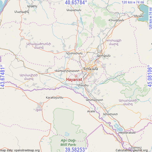
Hayanist GPS coordinates[2]
40° 7' 20.316" North, 44° 22' 40.548" East
| Map corner | latitude | longitude |
|---|---|---|
| Upper-left | 40.65784°, | 43.67481° |
| Center: | 40.12231°, | 44.37793° |
| Lower-right: | 39.58253°, | 45.08106° |
| Map W x H: | 119.6×119.6 km | = 74.3×74.3mi |
| max Lat: | 41.24358° ⇑65.3% North |
| Hayanist: | 40.12231° |
| min Lat: | ⇓34.7% South 38.90292° |
| min Long | Hayanist | max Long |
| 43.74722° | 44.37793° | 46.5446° |
| W 34.4%⇐ | ⇒65.6% E |
Elevation
Elevation of Hayanist is 843 m = 2766 ft, and this is 458.5 m = 1504 ft below average elevation for this country.
| Max E: |
2169 m = 7116 ft | 84.4% |
| Avg. | 1301.5 m = 4270 ft | |
| Hayanist | 843 m = 2766 ft | |
Min E: |
440 m = 1444 ft | 15.6% |
See also: Armenia elevation on elevation.city.
Geographical zone
Hayanist is located in North temperate zone (between Tropic of Cancer and the Arctic Circle). Distance of this Northern Tropic circle is 1855.3 km =1152.8 mi to South.| Distance of | km | miles | from Hayanist |
|---|---|---|---|
| North Pole | 5545.9 | 3446.1 | to North |
| Arctic Circle | 2940 | 1826.8 | to North |
| Tropic Cancer | 1855.3 | 1152.8 | to South |
| Equator | 4461.2 | 2772.1 | to South |


Nearby cities:
15 places around Hayanist: (largest is in red/bold)
• Arbat’
2.8 km =1.7 mi,  48°
48°
• Arevashat
2.5 km =1.6 mi,  354°
354°
• Argavand
6.2 km =3.9 mi,  56°
56°
• Darakert
3.6 km =2.2 mi,  121°
121°
• Dashtavan
2.7 km =1.7 mi,  154°
154°
• Geghanist
5.2 km =3.2 mi, 59°
• Ghukasavan
3.4 km =2.1 mi,  79°
79°
• Hovtashat
4 km =2.5 mi,  225°
225°
• Musalerr
3.7 km =2.3 mi,  0°
0°
• Nizami
4.1 km =2.5 mi, 145°
• Norabats’
5.1 km =3.2 mi,  111°
111°
• Ptghunk’
4.8 km =3 mi, 345°
• Sayat’-Nova
5.6 km =3.5 mi,  160°
160°
• Voskehat
4.6 km =2.9 mi,  298°
298°
• Zorak
3.7 km =2.3 mi, 157°
Sources, notices
• [Note1] Compared only with cities in Armenia existing in our database
• [Src1] Map data: © OpenStreetMap contributors (CC-BY-SA)
• [Src2] Other city data from geonames.org with taken over terms of usage.
• [Src3] Geographical zone / Annual Mean Temperature by Robert A. Rohde @ Wikipedia
