Geghanist geodata
Geghanist (Armavir) is a populated place; located in Armenia in Asia/Yerevan (GMT+4) time zone. With population of 2,409 people, there are 123 cities with bigger population in this country. Compared to other cities in Armenia, 59.2% of cities are located further ↑North; 58.3% of cities are located further →East and 73.6% of cities have higher elevation than Geghanist. Note1


Geghanist GPS coordinates[2]
40° 8' 45.132" North, 44° 25' 49.728" East
| Map corner | latitude | longitude |
|---|---|---|
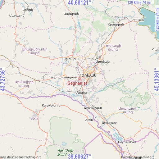
| Upper-left | 40.68121°, | 43.72736° |
| Center: | 40.14587°, | 44.43048° |
| Lower-right: | 39.60627°, | 45.13361° |
| Map W x H: | 119.5×119.5 km | = 74.3×74.3mi |
| max Lat: | 41.24358° ⇑59.2% North |
| Geghanist: | 40.14587° |
| min Lat: | ⇓40.8% South 38.90292° |
| min Long | Geghanist | max Long |
| 43.74722° | 44.43048° | 46.5446° |
| W 41.7%⇐ | ⇒58.3% E |
Elevation
Elevation of Geghanist is 868 m = 2848 ft, and this is 433.5 m = 1422 ft below average elevation for this country.
| Max E: |
2169 m = 7116 ft | 73.6% |
| Avg. | 1301.5 m = 4270 ft | |
| Geghanist | 868 m = 2848 ft | |
Min E: |
440 m = 1444 ft | 26.4% |
See also: Armenia elevation on elevation.city.
Geographical zone
Geghanist is located in North temperate zone (between Tropic of Cancer and the Arctic Circle). Distance of this Northern Tropic circle is 1857.9 km =1154.4 mi to South.| Distance of | km | miles | from Geghanist |
|---|---|---|---|
| North Pole | 5543.3 | 3444.4 | to North |
| Arctic Circle | 2937.4 | 1825.2 | to North |
| Tropic Cancer | 1857.9 | 1154.4 | to South |
| Equator | 4463.8 | 2773.7 | to South |


Nearby cities:
15 places around Geghanist: (largest is in red/bold)
• Arbat’
2.5 km =1.6 mi,  251°
251°
• Arevashat
4.7 km =2.9 mi,  268°
268°
• Argavand
1.1 km =0.7 mi,  42°
42°
• Aygek
6.1 km =3.8 mi,  321°
321°
• Baghramyan
7.5 km =4.7 mi, 316°
• Darakert
4.7 km =2.9 mi,  197°
197°
• Dashtavan
6.1 km =3.8 mi,  212°
212°
• Ghukasavan
2.3 km =1.4 mi, 210°
• Hayanist
5.2 km =3.2 mi,  239°
239°
• Merdzavan
4.7 km =2.9 mi,  327°
327°
• Musalerr
4.6 km =2.9 mi,  283°
283°
• Nizami
6.4 km =4 mi, 199°
• Norabats’
4.5 km =2.8 mi,  176°
176°
• Ptghunk’
6 km =3.7 mi,  289°
289°
• Zorak
6.8 km =4.2 mi, 206°
Sources, notices
• [Note1] Compared only with cities in Armenia existing in our database
• [Src1] Map data: © OpenStreetMap contributors (CC-BY-SA)
• [Src2] Other city data from geonames.org with taken over terms of usage.
• [Src3] Geographical zone / Annual Mean Temperature by Robert A. Rohde @ Wikipedia
