Hovtashat geodata
Hovtashat (Ararat) is a populated place; located in Armenia in Asia/Yerevan (GMT+4) time zone. With population of 3,472 people, there are 77 cities with bigger population in this country. Compared to other cities in Armenia, 68.8% of cities are located further ↑North; 69.1% of cities are located further →East and 90.1% of cities have higher elevation than Hovtashat. Note1


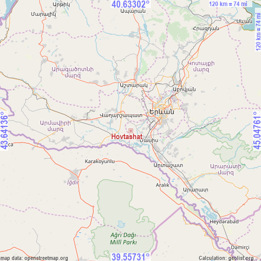
Hovtashat GPS coordinates[2]
40° 5' 50.244" North, 44° 20' 40.128" East
| Map corner | latitude | longitude |
|---|---|---|
| Upper-left | 40.63302°, | 43.64136° |
| Center: | 40.09729°, | 44.34448° |
| Lower-right: | 39.55731°, | 45.04761° |
| Map W x H: | 119.6×119.6 km | = 74.3×74.3mi |
| max Lat: | 41.24358° ⇑68.8% North |
| Hovtashat: | 40.09729° |
| min Lat: | ⇓31.2% South 38.90292° |
| min Long | Hovtashat | max Long |
| 43.74722° | 44.34448° | 46.5446° |
| W 30.9%⇐ | ⇒69.1% E |
Elevation
Elevation of Hovtashat is 836 m = 2743 ft, and this is 465.5 m = 1527 ft below average elevation for this country.
| Max E: |
2169 m = 7116 ft | 90.1% |
| Avg. | 1301.5 m = 4270 ft | |
| Hovtashat | 836 m = 2743 ft | |
Min E: |
440 m = 1444 ft | 9.9% |
See also: Armenia elevation on elevation.city.
Geographical zone
Hovtashat is located in North temperate zone (between Tropic of Cancer and the Arctic Circle). Distance of this Northern Tropic circle is 1852.5 km =1151.1 mi to South.| Distance of | km | miles | from Hovtashat |
|---|---|---|---|
| North Pole | 5548.7 | 3447.8 | to North |
| Arctic Circle | 2942.8 | 1828.6 | to North |
| Tropic Cancer | 1852.5 | 1151.1 | to South |
| Equator | 4458.4 | 2770.3 | to South |


Nearby cities:
15 places around Hovtashat: (largest is in red/bold)
• Aknashen
5 km =3.1 mi,  267°
267°
• Arak’s
5.8 km =3.6 mi,  217°
217°
• Arevashat
5.9 km =3.7 mi,  26°
26°
• Darakert
6 km =3.7 mi,  81°
81°
• Dashtavan
4 km =2.5 mi,  85°
85°
• Gay
3.6 km =2.2 mi,  246°
246°
• Griboyedov
6.4 km =4 mi,  285°
285°
• Hayanist
4 km =2.5 mi,  45°
45°
• Haykashen
4.1 km =2.5 mi,  227°
227°
• Metsamor
5.3 km =3.3 mi,  238°
238°
• Nizami
5.2 km =3.2 mi,  96°
96°
• Sayat’-Nova
5.3 km =3.3 mi,  117°
117°
• Sis
5.8 km =3.6 mi,  138°
138°
• Voskehat
5.1 km =3.2 mi,  346°
346°
• Zorak
4.3 km =2.7 mi, 98°
Sources, notices
• [Note1] Compared only with cities in Armenia existing in our database
• [Src1] Map data: © OpenStreetMap contributors (CC-BY-SA)
• [Src2] Other city data from geonames.org with taken over terms of usage.
• [Src3] Geographical zone / Annual Mean Temperature by Robert A. Rohde @ Wikipedia
