Haykashen geodata
Haykashen (Armavir) is a populated place; located in Armenia in Asia/Yerevan (GMT+4) time zone. With population of 1,140 people, there are 277 cities with bigger population in this country. Compared to other cities in Armenia, 72.9% of cities are located further ↑North; 70.4% of cities are located further →East and 89.2% of cities have higher elevation than Haykashen. Note1


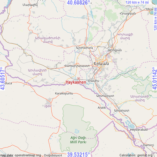
Haykashen GPS coordinates[2]
40° 4' 20.388" North, 44° 18' 29.844" East
| Map corner | latitude | longitude |
|---|---|---|
| Upper-left | 40.60826°, | 43.60517° |
| Center: | 40.07233°, | 44.30829° |
| Lower-right: | 39.53215°, | 45.01142° |
| Map W x H: | 119.7×119.7 km | = 74.4×74.4mi |
| max Lat: | 41.24358° ⇑72.9% North |
| Haykashen: | 40.07233° |
| min Lat: | ⇓27.1% South 38.90292° |
| min Long | Haykashen | max Long |
| 43.74722° | 44.30829° | 46.5446° |
| W 29.6%⇐ | ⇒70.4% E |
Elevation
Elevation of Haykashen is 837 m = 2746 ft, and this is 464.5 m = 1524 ft below average elevation for this country.
| Max E: |
2169 m = 7116 ft | 89.2% |
| Avg. | 1301.5 m = 4270 ft | |
| Haykashen | 837 m = 2746 ft | |
Min E: |
440 m = 1444 ft | 10.8% |
See also: Armenia elevation on elevation.city.
Geographical zone
Haykashen is located in North temperate zone (between Tropic of Cancer and the Arctic Circle). Distance of this Northern Tropic circle is 1849.7 km =1149.3 mi to South.| Distance of | km | miles | from Haykashen |
|---|---|---|---|
| North Pole | 5551.4 | 3449.5 | to North |
| Arctic Circle | 2945.5 | 1830.2 | to North |
| Tropic Cancer | 1849.7 | 1149.3 | to South |
| Equator | 4455.6 | 2768.6 | to South |


Nearby cities:
15 places around Haykashen: (largest is in red/bold)
• Aknashen
3.2 km =2 mi,  323°
323°
• Apaga
5.5 km =3.4 mi,  300°
300°
• Arak’s
1.9 km =1.2 mi,  193°
193°
• Dashtavan
7.7 km =4.8 mi,  66°
66°
• Gay
1.4 km =0.9 mi,  349°
349°
• Griboyedov
5.5 km =3.4 mi,  325°
325°
• Hayanist
8.1 km =5 mi,  46°
46°
• Hovtashat
4.1 km =2.5 mi, 47°
• Metsamor
1.4 km =0.9 mi,  270°
270°
• Rranch’par
7.2 km =4.5 mi,  133°
133°
• Sayat’-Nova
7.8 km =4.8 mi,  87°
87°
• Sis
7 km =4.3 mi,  102°
102°
• Voskehat
7.9 km =4.9 mi,  13°
13°
• Yeraskhahun
7.6 km =4.7 mi, 270°
• Zorak
7.6 km =4.7 mi, 73°
Sources, notices
• [Note1] Compared only with cities in Armenia existing in our database
• [Src1] Map data: © OpenStreetMap contributors (CC-BY-SA)
• [Src2] Other city data from geonames.org with taken over terms of usage.
• [Src3] Geographical zone / Annual Mean Temperature by Robert A. Rohde @ Wikipedia
