San Carlos geodata
San Carlos (Corrientes) is a populated place; located in Argentina in America/Argentina/Cordoba (GMT-3) time zone. With population of 3,350 people, there are 532 cities with bigger population in this country. Compared to other cities in Argentina, 76.9% of cities are located further ↓South; 94% of cities are located further ←West and 58.9% of cities have lower elevation than San Carlos. Note1


San Carlos GPS coordinates[2]
27° 44' 45.096" South, 55° 53' 50.316" West
| Map corner | latitude | longitude |
|---|---|---|
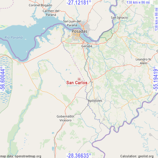
| Upper-left | -27.12181°, | -56.60044° |
| Center: | -27.74586°, | -55.89731° |
| Lower-right: | -28.36635°, | -55.19419° |
| Map W x H: | 138.4×138.4 km | = 86×86mi |
| max Lat: | -21.94467° ⇑23.1% North |
| San Carlos: | -27.74586° |
| min Lat: | ⇓76.9% South -54.81084° |
| min Long | San Carlos | max Long |
| -72.88605° | -55.89731° | -53.64581° |
| W 94%⇐ | ⇒6% E |
Elevation
Elevation of San Carlos is 205 m = 673 ft, and this is 144.3 m = 473 ft below average elevation for this country.
| Max E: |
4040 m = 13255 ft | 41.1% |
| Avg. | 349.3 m = 1146 ft | |
| San Carlos | 205 m = 673 ft | |
Min E: |
-2 m = -7 ft | 58.9% |
See also: Argentina elevation on elevation.city.
Geographical zone
San Carlos is located in South temperate zone (between Tropic of Capricorn and the Antarctic Circle). Distance of this Southern Tropic circle is 479.1 km =297.7 mi to North.| Distance of | km | miles | from San Carlos |
|---|---|---|---|
| Equator | 3085.1 | 1917 | to North |
| Tropic Capricorn | 479.1 | 297.7 | to North |
| Antarctic Circle | 4316.1 | 2681.9 | to South |
| South Pole | 6922 | 4301.1 | to South |


Nearby cities:
15 places around San Carlos: (largest is in red/bold)
• Apóstoles
23.5 km =14.6 mi,  142°
142°
• Arroyo del Medio
48.9 km =30.4 mi,  83°
83°
• Azara
41.2 km =25.6 mi,  148°
148°
• Bonpland
50.7 km =31.5 mi,  54°
54°
• Candelaria
35.2 km =21.9 mi,  25°
25°
• Cerro Azul
41.4 km =25.7 mi,  72°
72°
• Cerro Corá
38.4 km =23.9 mi, 47°
• Concepción de la Sierra
45.5 km =28.3 mi,  125°
125°
• Garupá
30.1 km =18.7 mi,  12°
12°
• Gobernador Virasora
36.4 km =22.6 mi,  201°
201°
• Posadas
42.1 km =26.2 mi,  0°
0°
• San José
11.6 km =7.2 mi,  103°
103°
• Santa Ana
52.4 km =32.6 mi,  36°
36°
• Santa María
52.6 km =32.7 mi,  113°
113°
• Tres Capones
40.8 km =25.4 mi, 135°
Sources, notices
• [Note1] Compared only with cities in Argentina existing in our database
• [Src1] Map data: © OpenStreetMap contributors (CC-BY-SA)
• [Src2] Other city data from geonames.org with taken over terms of usage.
• [Src3] Geographical zone / Annual Mean Temperature by Robert A. Rohde @ Wikipedia
