Puerto Esperanza geodata
Puerto Esperanza (Misiones) is a seat of a second-order administrative division; located in Argentina in America/Argentina/Cordoba (GMT-3) time zone. With population of 15,579 people, there are 217 cities with bigger population in this country. Compared to other cities in Argentina, 92.4% of cities are located further ↓South; 99.2% of cities are located further ←West and 51% of cities have lower elevation than Puerto Esperanza. Note1


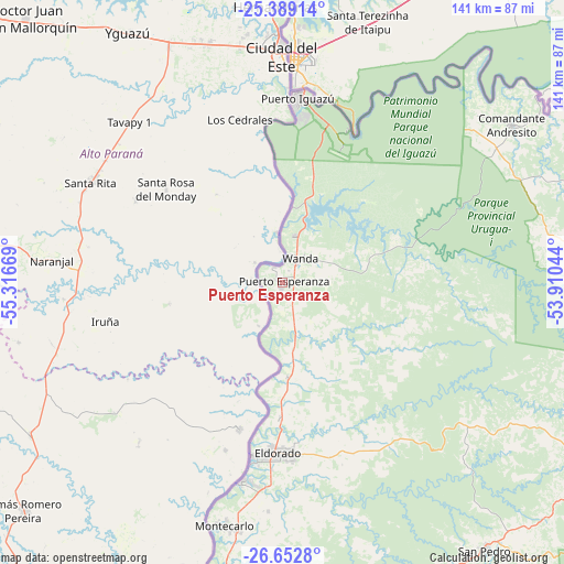
Puerto Esperanza GPS coordinates[2]
26° 1' 21.612" South, 54° 36' 48.816" West
| Map corner | latitude | longitude |
|---|---|---|
| Upper-left | -25.38914°, | -55.31669° |
| Center: | -26.02267°, | -54.61356° |
| Lower-right: | -26.6528°, | -53.91044° |
| Map W x H: | 140.5×140.5 km | = 87.3×87.3mi |
| max Lat: | -21.94467° ⇑7.6% North |
| Puerto Esperanza: | -26.02267° |
| min Lat: | ⇓92.4% South -54.81084° |
| min Long | Puerto Esperanz | max Long |
| -72.88605° | -54.61356° | -53.64581° |
| W 99.2%⇐ | ⇒0.8% E |
Elevation
Elevation of Puerto Esperanza is 152 m = 499 ft, and this is 197.3 m = 647 ft below average elevation for this country.
| Max E: |
4040 m = 13255 ft | 49% |
| Avg. | 349.3 m = 1146 ft | |
| Puerto Esperanza | 152 m = 499 ft | |
Min E: |
-2 m = -7 ft | 51% |
See also: Argentina elevation on elevation.city.
Geographical zone
Puerto Esperanza is located in South temperate zone (between Tropic of Capricorn and the Antarctic Circle). Distance of this Southern Tropic circle is 287.5 km =178.6 mi to North.| Distance of | km | miles | from Puerto Esperanza |
|---|---|---|---|
| Equator | 2893.4 | 1797.9 | to North |
| Tropic Capricorn | 287.5 | 178.6 | to North |
| Antarctic Circle | 4507.7 | 2801 | to South |
| South Pole | 7113.6 | 4420.2 | to South |


Nearby cities:
15 places around Puerto Esperanza: (largest is in red/bold)
• Bernardo de Irigoyen
100 km =62.1 mi,  104°
104°
• Capioví
110.3 km =68.5 mi,  203°
203°
• Caraguatay
67 km =41.6 mi,  194°
194°
• El Alcázar
79.5 km =49.4 mi, 194°
• Eldorado
42.5 km =26.4 mi,  181°
181°
• Garuhapé
94.8 km =58.9 mi, 201°
• Montecarlo
62.1 km =38.6 mi, 193°
• Puerto Eldorado
43.6 km =27.1 mi, 190°
• Puerto Iguazú
47.3 km =29.4 mi,  4°
4°
• Puerto Libertad
11.9 km =7.4 mi,  15°
15°
• Puerto Piray
50.5 km =31.4 mi, 190°
• Puerto Rico
95.2 km =59.2 mi,  205°
205°
• San Pedro
83.5 km =51.9 mi,  142°
142°
• San Vicente
81.6 km =50.7 mi, 144°
• Wanda
7.8 km =4.8 mi,  40°
40°
Sources, notices
• [Note1] Compared only with cities in Argentina existing in our database
• [Src1] Map data: © OpenStreetMap contributors (CC-BY-SA)
• [Src2] Other city data from geonames.org with taken over terms of usage.
• [Src3] Geographical zone / Annual Mean Temperature by Robert A. Rohde @ Wikipedia
