Bernardo de Irigoyen geodata
Bernardo de Irigoyen (Misiones) is a seat of a second-order administrative division; located in Argentina in America/Argentina/Cordoba (GMT-3) time zone. With population of 10,889 people, there are 275 cities with bigger population in this country. Compared to other cities in Argentina, 91.3% of cities are located further ↓South; 100% of cities are located further ←West and 88.8% of cities have lower elevation than Bernardo de Irigoyen. Note1


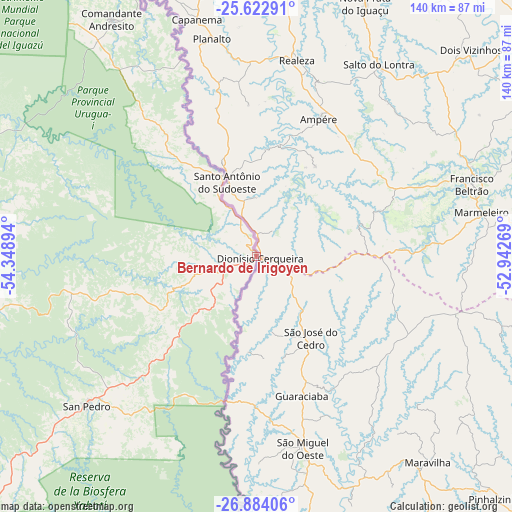
Bernardo de Irigoyen GPS coordinates[2]
26° 15' 18.72" South, 53° 38' 44.916" West
| Map corner | latitude | longitude |
|---|---|---|
| Upper-left | -25.62291°, | -54.34894° |
| Center: | -26.2552°, | -53.64581° |
| Lower-right: | -26.88406°, | -52.94269° |
| Map W x H: | 140.2×140.2 km | = 87.1×87.1mi |
| max Lat: | -21.94467° ⇑8.7% North |
| Bernardo de Irigoyen: | -26.2552° |
| min Lat: | ⇓91.3% South -54.81084° |
| min Long | Bernardo de Iri | max Long |
| -72.88605° | -53.64581° | -53.64581° |
| W 100%⇐ | ⇒0% E |
Elevation
Elevation of Bernardo de Irigoyen is 815 m = 2674 ft, and this is 465.7 m = 1528 ft above average elevation for this country.
| Max E: |
4040 m = 13255 ft | 11.2% |
| Bernardo de Irigoyen | 815 m 2674 ft | |
| Avg. | 349.3 m = 1146 ft | |
Min E: |
-2 m = -7 ft | 88.8% |
See also: Argentina elevation on elevation.city.
Geographical zone
Bernardo de Irigoyen is located in South temperate zone (between Tropic of Capricorn and the Antarctic Circle). Distance of this Southern Tropic circle is 313.4 km =194.7 mi to North.| Distance of | km | miles | from Bernardo de Irigoyen |
|---|---|---|---|
| Equator | 2919.3 | 1814 | to North |
| Tropic Capricorn | 313.4 | 194.7 | to North |
| Antarctic Circle | 4481.9 | 2784.9 | to South |
| South Pole | 7087.8 | 4404.2 | to South |


Nearby cities:
15 places around Bernardo de Irigoyen: (largest is in red/bold)
• Caraguatay
119.6 km =74.3 mi,  250°
250°
• Dos de Mayo
134.1 km =83.3 mi,  230°
230°
• El Alcázar
127.1 km =79 mi, 246°
• El Soberbio
128.3 km =79.7 mi,  205°
205°
• Eldorado
99 km =61.5 mi,  260°
260°
• Garuhapé
144.6 km =89.9 mi,  244°
244°
• Montecarlo
115.9 km =72 mi, 252°
• Puerto Eldorado
105.9 km =65.8 mi, 260°
• Puerto Esperanza
100 km =62.1 mi,  284°
284°
• Puerto Iguazú
118 km =73.3 mi,  308°
308°
• Puerto Libertad
100.7 km =62.6 mi,  291°
291°
• Puerto Piray
108.4 km =67.4 mi, 257°
• San Pedro
61.5 km =38.2 mi, 228°
• San Vicente
63 km =39.1 mi, 230°
• Wanda
96.9 km =60.2 mi, 289°
Sources, notices
• [Note1] Compared only with cities in Argentina existing in our database
• [Src1] Map data: © OpenStreetMap contributors (CC-BY-SA)
• [Src2] Other city data from geonames.org with taken over terms of usage.
• [Src3] Geographical zone / Annual Mean Temperature by Robert A. Rohde @ Wikipedia
