San Vicente geodata
San Vicente (Misiones) is a populated place; located in Argentina in America/Argentina/Cordoba (GMT-3) time zone. With population of 38,247 people, there are 112 cities with bigger population in this country. Compared to other cities in Argentina, 89.6% of cities are located further ↓South; 99.8% of cities are located further ←West and 81.6% of cities have lower elevation than San Vicente. Note1


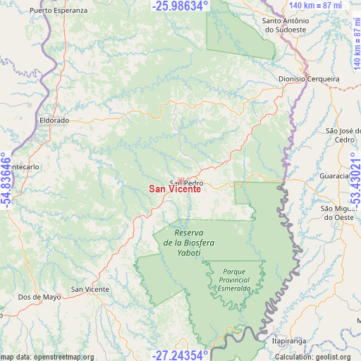
San Vicente GPS coordinates[2]
26° 37' 0.012" South, 54° 7' 59.988" West
| Map corner | latitude | longitude |
|---|---|---|
| Upper-left | -25.98634°, | -54.83646° |
| Center: | -26.61667°, | -54.13333° |
| Lower-right: | -27.24354°, | -53.43021° |
| Map W x H: | 139.8×139.8 km | = 86.9×86.9mi |
| max Lat: | -21.94467° ⇑10.4% North |
| San Vicente: | -26.61667° |
| min Lat: | ⇓89.6% South -54.81084° |
| min Long | San Vicente | max Long |
| -72.88605° | -54.13333° | -53.64581° |
| W 99.8%⇐ | ⇒0.2% E |
Elevation
Elevation of San Vicente is 603 m = 1978 ft, and this is 253.7 m = 832 ft above average elevation for this country.
| Max E: |
4040 m = 13255 ft | 18.4% |
| San Vicente | 603 m 1978 ft | |
| Avg. | 349.3 m = 1146 ft | |
Min E: |
-2 m = -7 ft | 81.6% |
See also: Argentina elevation on elevation.city.
Geographical zone
San Vicente is located in South temperate zone (between Tropic of Capricorn and the Antarctic Circle). Distance of this Southern Tropic circle is 353.6 km =219.7 mi to North.| Distance of | km | miles | from San Vicente |
|---|---|---|---|
| Equator | 2959.5 | 1838.9 | to North |
| Tropic Capricorn | 353.6 | 219.7 | to North |
| Antarctic Circle | 4441.7 | 2759.9 | to South |
| South Pole | 7047.6 | 4379.2 | to South |


Nearby cities:
15 places around San Vicente: (largest is in red/bold)
• Bernardo de Irigoyen
63 km =39.1 mi,  50°
50°
• Caraguatay
64.4 km =40 mi,  271°
271°
• Dos de Mayo
71.1 km =44.2 mi,  230°
230°
• El Alcázar
68.6 km =42.6 mi,  260°
260°
• El Soberbio
76.1 km =47.3 mi,  184°
184°
• Eldorado
54.3 km =33.7 mi,  295°
295°
• Garuhapé
84.8 km =52.7 mi,  254°
254°
• Montecarlo
62.3 km =38.7 mi,  275°
275°
• Puerto Eldorado
60.5 km =37.6 mi,  292°
292°
• Puerto Esperanza
81.6 km =50.7 mi,  324°
324°
• Puerto Libertad
89.5 km =55.6 mi,  329°
329°
• Puerto Piray
59.4 km =36.9 mi, 286°
• Puerto Rico
90.7 km =56.4 mi, 257°
• San Pedro
2.5 km =1.6 mi,  103°
103°
• Wanda
83.8 km =52.1 mi, 329°
Sources, notices
• [Note1] Compared only with cities in Argentina existing in our database
• [Src1] Map data: © OpenStreetMap contributors (CC-BY-SA)
• [Src2] Other city data from geonames.org with taken over terms of usage.
• [Src3] Geographical zone / Annual Mean Temperature by Robert A. Rohde @ Wikipedia
