El Alcázar geodata
El Alcázar (Misiones) is a populated place; located in Argentina in America/Argentina/Cordoba (GMT-3) time zone. With population of 5,127 people, there are 441 cities with bigger population in this country. Compared to other cities in Argentina, 88.8% of cities are located further ↓South; 98.3% of cities are located further ←West and 59.8% of cities have lower elevation than El Alcázar. Note1
Administrative division(s):
- Level 1: Misiones
- Level 2: Departamento de Libertador General San Martín


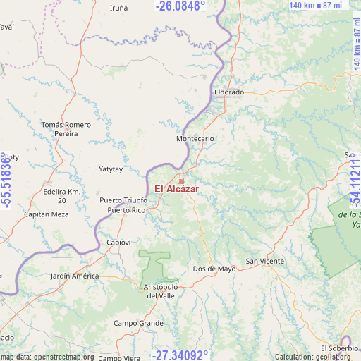
El Alcázar GPS coordinates[2]
26° 42' 52.524" South, 54° 48' 54.828" West
| Map corner | latitude | longitude |
|---|---|---|
| Upper-left | -26.0848°, | -55.51836° |
| Center: | -26.71459°, | -54.81523° |
| Lower-right: | -27.34092°, | -54.11211° |
| Map W x H: | 139.7×139.7 km | = 86.8×86.8mi |
| max Lat: | -21.94467° ⇑11.2% North |
| El Alcázar: | -26.71459° |
| min Lat: | ⇓88.8% South -54.81084° |
| min Long | El Alcázar | max Long |
| -72.88605° | -54.81523° | -53.64581° |
| W 98.3%⇐ | ⇒1.7% E |
Elevation
Elevation of El Alcázar is 210 m = 689 ft, and this is 139.3 m = 457 ft below average elevation for this country.
| Max E: |
4040 m = 13255 ft | 40.2% |
| Avg. | 349.3 m = 1146 ft | |
| El Alcázar | 210 m = 689 ft | |
Min E: |
-2 m = -7 ft | 59.8% |
See also: Argentina elevation on elevation.city.
Geographical zone
El Alcázar is located in South temperate zone (between Tropic of Capricorn and the Antarctic Circle). Distance of this Southern Tropic circle is 364.5 km =226.5 mi to North.| Distance of | km | miles | from El Alcázar |
|---|---|---|---|
| Equator | 2970.4 | 1845.7 | to North |
| Tropic Capricorn | 364.5 | 226.5 | to North |
| Antarctic Circle | 4430.8 | 2753.2 | to South |
| South Pole | 7036.7 | 4372.4 | to South |


Nearby cities:
15 places around El Alcázar: (largest is in red/bold)
• Aristóbulo del Valle
43.2 km =26.8 mi,  190°
190°
• Campo Grande
57.2 km =35.5 mi,  196°
196°
• Capioví
34.2 km =21.3 mi,  225°
225°
• Caraguatay
12.6 km =7.8 mi,  15°
15°
• Dos de Mayo
36.6 km =22.7 mi,  159°
159°
• Eldorado
39.3 km =24.4 mi,  28°
28°
• Garuhapé
18.1 km =11.2 mi, 230°
• Jardín América
54.8 km =34.1 mi, 228°
• Montecarlo
17.5 km =10.9 mi, 19°
• Puerto Eldorado
36.1 km =22.4 mi, 19°
• Puerto Leoni
46.2 km =28.7 mi, 228°
• Puerto Piray
29.3 km =18.2 mi, 21°
• Puerto Rico
22.6 km =14 mi,  246°
246°
• Ruiz de Montoya
37.9 km =23.5 mi,  217°
217°
• San Vicente
68.6 km =42.6 mi,  80°
80°
Sources, notices
• [Note1] Compared only with cities in Argentina existing in our database
• [Src1] Map data: © OpenStreetMap contributors (CC-BY-SA)
• [Src2] Other city data from geonames.org with taken over terms of usage.
• [Src3] Geographical zone / Annual Mean Temperature by Robert A. Rohde @ Wikipedia
