Oberá geodata
Oberá (Misiones) is a seat of a second-order administrative division; located in Argentina in America/Argentina/Cordoba (GMT-3) time zone. With population of 56,528 people, there are 77 cities with bigger population in this country. Compared to other cities in Argentina, 80.8% of cities are located further ↓South; 97.2% of cities are located further ←West and 70% of cities have lower elevation than Oberá. Note1


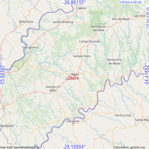
Oberá GPS coordinates[2]
27° 29' 13.416" South, 55° 7' 11.784" West
| Map corner | latitude | longitude |
|---|---|---|
| Upper-left | -26.86155°, | -55.82307° |
| Center: | -27.48706°, | -55.11994° |
| Lower-right: | -28.10904°, | -54.41682° |
| Map W x H: | 138.7×138.7 km | = 86.2×86.2mi |
| max Lat: | -21.94467° ⇑19.2% North |
| Oberá: | -27.48706° |
| min Lat: | ⇓80.8% South -54.81084° |
| min Long | Oberá | max Long |
| -72.88605° | -55.11994° | -53.64581° |
| W 97.2%⇐ | ⇒2.8% E |
Elevation
Elevation of Oberá is 345 m = 1132 ft, and this is 4.3 m = 14 ft below average elevation for this country.
| Max E: |
4040 m = 13255 ft | 30% |
| Avg. | 349.3 m = 1146 ft | |
| Oberá | 345 m = 1132 ft | |
Min E: |
-2 m = -7 ft | 70% |
See also: Oberá elevation on elevation.city.
Geographical zone
Oberá is located in South temperate zone (between Tropic of Capricorn and the Antarctic Circle). Distance of this Southern Tropic circle is 450.4 km =279.9 mi to North.| Distance of | km | miles | from Oberá |
|---|---|---|---|
| Equator | 3056.3 | 1899.1 | to North |
| Tropic Capricorn | 450.4 | 279.9 | to North |
| Antarctic Circle | 4344.9 | 2699.8 | to South |
| South Pole | 6950.8 | 4319 | to South |


Nearby cities:
15 places around Oberá: (largest is in red/bold)
• Almafuerte
28 km =17.4 mi,  265°
265°
• Bonpland
35.3 km =21.9 mi, 270°
• Campo Grande
34 km =21.1 mi,  24°
24°
• Campo Ramón
10.4 km =6.5 mi,  69°
69°
• Campo Viera
18.3 km =11.4 mi, 20°
• Dos Arroyos
27 km =16.8 mi,  208°
208°
• Florentino Ameghino
8.9 km =5.5 mi,  188°
188°
• General Alvear
8.3 km =5.2 mi,  324°
324°
• Guaraní
5.7 km =3.5 mi,  225°
225°
• Leandro N. Alem
24 km =14.9 mi,  237°
237°
• Los Helechos
8.1 km =5 mi,  150°
150°
• Mojón Grande
25.2 km =15.7 mi, 188°
• Mártires
26.3 km =16.3 mi,  285°
285°
• Panambí
33.2 km =20.6 mi,  142°
142°
• Picada Gobernador López
23.9 km =14.9 mi, 211°
Sources, notices
• [Note1] Compared only with cities in Argentina existing in our database
• [Src1] Map data: © OpenStreetMap contributors (CC-BY-SA)
• [Src2] Other city data from geonames.org with taken over terms of usage.
• [Src3] Geographical zone / Annual Mean Temperature by Robert A. Rohde @ Wikipedia
