Campo Grande geodata
Campo Grande (Misiones) is a seat of a second-order administrative division; located in Argentina in America/Argentina/Cordoba (GMT-3) time zone. With population of 12,040 people, there are 256 cities with bigger population in this country. Compared to other cities in Argentina, 84.4% of cities are located further ↓South; 97.9% of cities are located further ←West and 75.4% of cities have lower elevation than Campo Grande. Note1


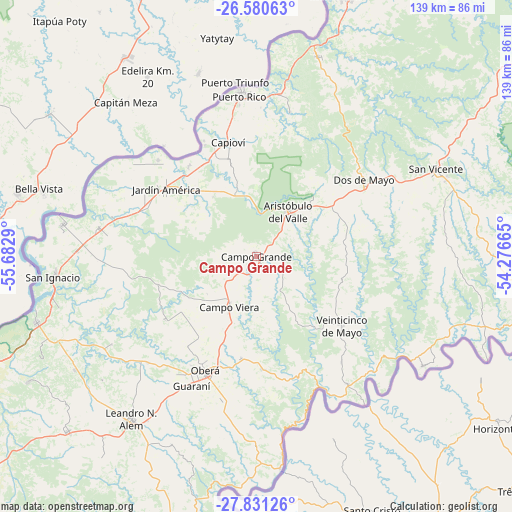
Campo Grande GPS coordinates[2]
27° 12' 27.72" South, 54° 58' 47.172" West
| Map corner | latitude | longitude |
|---|---|---|
| Upper-left | -26.58063°, | -55.6829° |
| Center: | -27.2077°, | -54.97977° |
| Lower-right: | -27.83126°, | -54.27665° |
| Map W x H: | 139.1×139.1 km | = 86.4×86.4mi |
| max Lat: | -21.94467° ⇑15.6% North |
| Campo Grande: | -27.2077° |
| min Lat: | ⇓84.4% South -54.81084° |
| min Long | Campo Grande | max Long |
| -72.88605° | -54.97977° | -53.64581° |
| W 97.9%⇐ | ⇒2.1% E |
Elevation
Elevation of Campo Grande is 454 m = 1490 ft, and this is 104.7 m = 344 ft above average elevation for this country.
| Max E: |
4040 m = 13255 ft | 24.6% |
| Campo Grande | 454 m 1490 ft | |
| Avg. | 349.3 m = 1146 ft | |
Min E: |
-2 m = -7 ft | 75.4% |
See also: Argentina elevation on elevation.city.
Geographical zone
Campo Grande is located in South temperate zone (between Tropic of Capricorn and the Antarctic Circle). Distance of this Southern Tropic circle is 419.3 km =260.5 mi to North.| Distance of | km | miles | from Campo Grande |
|---|---|---|---|
| Equator | 3025.2 | 1879.8 | to North |
| Tropic Capricorn | 419.3 | 260.5 | to North |
| Antarctic Circle | 4376 | 2719.1 | to South |
| South Pole | 6981.8 | 4338.3 | to South |


Nearby cities:
15 places around Campo Grande: (largest is in red/bold)
• Aristóbulo del Valle
14.9 km =9.3 mi,  33°
33°
• Campo Ramón
27.8 km =17.3 mi,  188°
188°
• Campo Viera
15.8 km =9.8 mi,  208°
208°
• Capioví
31.9 km =19.8 mi,  345°
345°
• Dos de Mayo
35.6 km =22.1 mi,  54°
54°
• Florentino Ameghino
42.7 km =26.5 mi,  200°
200°
• General Alvear
30.7 km =19.1 mi,  217°
217°
• Guaraní
39.4 km =24.5 mi, 206°
• Jardín América
30.5 km =19 mi,  306°
306°
• Los Helechos
39.4 km =24.5 mi, 194°
• Oberá
34 km =21.1 mi, 204°
• Puerto Leoni
30.6 km =19 mi,  323°
323°
• Ruiz de Montoya
25.9 km =16.1 mi,  344°
344°
• Santo Pipó
43.1 km =26.8 mi,  279°
279°
• Veinticinco de Mayo
30 km =18.6 mi,  128°
128°
Sources, notices
• [Note1] Compared only with cities in Argentina existing in our database
• [Src1] Map data: © OpenStreetMap contributors (CC-BY-SA)
• [Src2] Other city data from geonames.org with taken over terms of usage.
• [Src3] Geographical zone / Annual Mean Temperature by Robert A. Rohde @ Wikipedia
