Mercedes geodata
Mercedes (Corrientes) is a seat of a second-order administrative division; located in Argentina in America/Argentina/Cordoba (GMT-3) time zone. With population of 30,649 people, there are 137 cities with bigger population in this country. Compared to other cities in Argentina, 67.6% of cities are located further ↓South; 88.6% of cities are located further ←West and 63.7% of cities have higher elevation than Mercedes. Note1


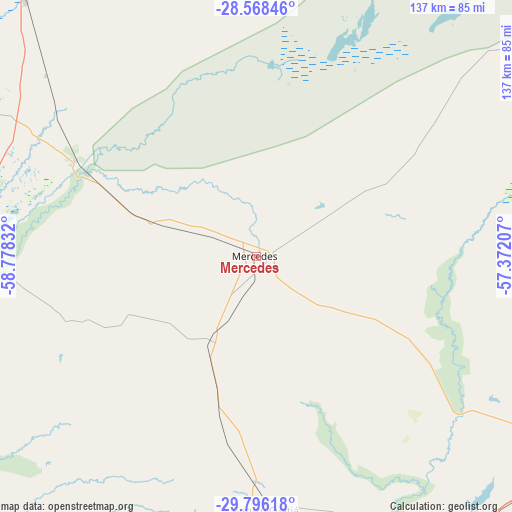
Mercedes GPS coordinates[2]
29° 11' 2.976" South, 58° 4' 30.684" West
| Map corner | latitude | longitude |
|---|---|---|
| Upper-left | -28.56846°, | -58.77832° |
| Center: | -29.18416°, | -58.07519° |
| Lower-right: | -29.79618°, | -57.37207° |
| Map W x H: | 136.5×136.5 km | = 84.8×84.8mi |
| max Lat: | -21.94467° ⇑32.4% North |
| Mercedes: | -29.18416° |
| min Lat: | ⇓67.6% South -54.81084° |
| min Long | Mercedes | max Long |
| -72.88605° | -58.07519° | -53.64581° |
| W 88.6%⇐ | ⇒11.4% E |
Elevation
Elevation of Mercedes is 96 m = 315 ft, and this is 253.3 m = 831 ft below average elevation for this country.
| Max E: |
4040 m = 13255 ft | 63.7% |
| Avg. | 349.3 m = 1146 ft | |
| Mercedes | 96 m = 315 ft | |
Min E: |
-2 m = -7 ft | 36.3% |
See also: Argentina elevation on elevation.city.
Geographical zone
Mercedes is located in South temperate zone (between Tropic of Capricorn and the Antarctic Circle). Distance of this Southern Tropic circle is 639.1 km =397.1 mi to North.| Distance of | km | miles | from Mercedes |
|---|---|---|---|
| Equator | 3245 | 2016.3 | to North |
| Tropic Capricorn | 639.1 | 397.1 | to North |
| Antarctic Circle | 4156.2 | 2582.5 | to South |
| South Pole | 6762.1 | 4201.8 | to South |


Nearby cities:
15 places around Mercedes: (largest is in red/bold)
• Bonpland
94.1 km =58.5 mi,  138°
138°
• Chavarría
54.7 km =34 mi,  297°
297°
• Concepción
90 km =55.9 mi,  11°
11°
• Cruz de los Milagros
98.3 km =61.1 mi,  293°
293°
• Curuzú Cuatiá
67.6 km =42 mi,  178°
178°
• Felipe Yofré
27.1 km =16.8 mi, 289°
• Gobernador Juan E. Martínez
89 km =55.3 mi, 289°
• Libertad
98.6 km =61.3 mi,  165°
165°
• Mariano I. Loza
24.3 km =15.1 mi,  208°
208°
• Nueve de Julio
82.4 km =51.2 mi, 297°
• Pedro R. Fernández
74.2 km =46.1 mi,  310°
310°
• Perugorría
54.8 km =34.1 mi,  251°
251°
• San Roque
91.6 km =56.9 mi,  317°
317°
• Santa Lucía
102.2 km =63.5 mi,  282°
282°
• Yataity Calle
83 km =51.6 mi, 282°
Sources, notices
• [Note1] Compared only with cities in Argentina existing in our database
• [Src1] Map data: © OpenStreetMap contributors (CC-BY-SA)
• [Src2] Other city data from geonames.org with taken over terms of usage.
• [Src3] Geographical zone / Annual Mean Temperature by Robert A. Rohde @ Wikipedia
