Gobernador Juan E. Martínez geodata
Gobernador Juan E. Martínez (Corrientes) is a populated place; located in Argentina in America/Argentina/Cordoba (GMT-3) time zone. With population of 3,529 people, there are 521 cities with bigger population in this country. Compared to other cities in Argentina, 69.3% of cities are located further ↓South; 77.5% of cities are located further ←West and 78.2% of cities have higher elevation than Gobernador Juan E. Martínez. Note1
Current local time in Gobernador Juan E. Martínez:
05:15 AM, SaturdayDifference from your time zone: hours


Gobernador Juan E. Martínez GPS coordinates[2]
28° 54' 41.796" South, 58° 56' 9.384" West
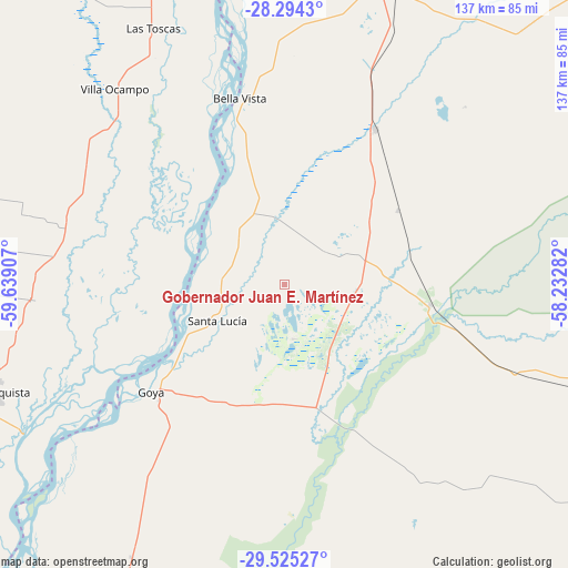
| Map corner | latitude | longitude |
|---|---|---|
| Upper-left | -28.2943°, | -59.63907° |
| Center: | -28.91161°, | -58.93594° |
| Lower-right: | -29.52527°, | -58.23282° |
| Map W x H: | 136.9×136.9 km | = 85.1×85.1mi |
| max Lat: | -21.94467° ⇑30.7% North |
| Gobernador Juan E. Martínez: | -28.91161° |
| min Lat: | ⇓69.3% South -54.81084° |
| min Long | Gobernador Juan | max Long |
| -72.88605° | -58.93594° | -53.64581° |
| W 77.5%⇐ | ⇒22.5% E |
Elevation
Elevation of Gobernador Juan E. Martínez is 64 m = 210 ft, and this is 285.3 m = 936 ft below average elevation for this country.
| Max E: |
4040 m = 13255 ft | 78.2% |
| Avg. | 349.3 m = 1146 ft | |
| Gobernador Juan E. Martínez | 64 m = 210 ft | |
Min E: |
-2 m = -7 ft | 21.8% |
See also: Argentina elevation on elevation.city.
Geographical zone
Gobernador Juan E. Martínez is located in South temperate zone (between Tropic of Capricorn and the Antarctic Circle). Distance of this Southern Tropic circle is 608.8 km =378.3 mi to North.| Distance of | km | miles | from Gobernador Juan E. Martínez |
|---|---|---|---|
| Equator | 3214.7 | 1997.5 | to North |
| Tropic Capricorn | 608.8 | 378.3 | to North |
| Antarctic Circle | 4186.5 | 2601.4 | to South |
| South Pole | 6792.4 | 4220.6 | to South |


Nearby cities:
15 places around Gobernador Juan E. Martínez: (largest is in red/bold)
• Avellaneda
73.9 km =45.9 mi,  251°
251°
• Bella Vista
46.1 km =28.6 mi,  347°
347°
• Chavarría
35.7 km =22.2 mi,  97°
97°
• Cruz de los Milagros
10.7 km =6.6 mi,  321°
321°
• Felipe Yofré
61.9 km =38.5 mi,  110°
110°
• Goya
40.7 km =25.3 mi,  231°
231°
• Las Toscas
69.6 km =43.2 mi,  333°
333°
• Nueve de Julio
13.3 km =8.3 mi,  53°
53°
• Pedro R. Fernández
32.6 km =20.3 mi,  56°
56°
• Perugorría
57.3 km =35.6 mi,  146°
146°
• San Roque
43.6 km =27.1 mi,  30°
30°
• Santa Lucía
18.3 km =11.4 mi,  242°
242°
• Tacuarendí
63.9 km =39.7 mi, 330°
• Villa Ocampo
62.4 km =38.8 mi, 319°
• Yataity Calle
12.3 km =7.6 mi,  167°
167°
Sources, notices
• [Note1] Compared only with cities in Argentina existing in our database
• [Src1] Map data: © OpenStreetMap contributors (CC-BY-SA)
• [Src2] Other city data from geonames.org with taken over terms of usage.
• [Src3] Geographical zone / Annual Mean Temperature by Robert A. Rohde @ Wikipedia
