General Belgrano geodata
General Belgrano (Buenos Aires) is a seat of a second-order administrative division; located in Argentina in America/Argentina/Buenos_Aires (GMT-3) time zone. In our database, there are 785 cities with bigger population. Compared to other cities in Argentina, 81% of cities are located further ↑North; 83.7% of cities are located further ←West and 93.2% of cities have higher elevation than General Belgrano. Note1


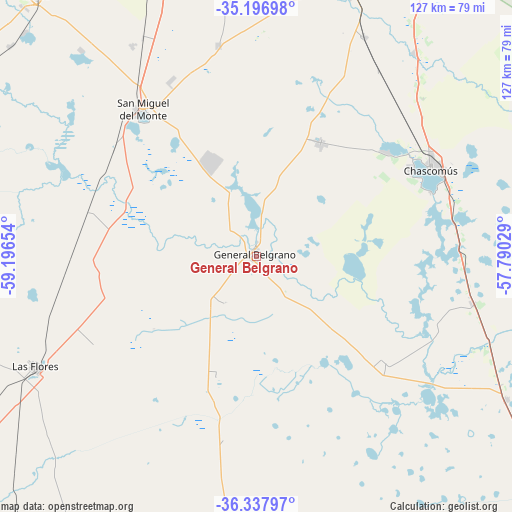
General Belgrano GPS coordinates[2]
35° 46' 10.272" South, 58° 29' 36.276" West
| Map corner | latitude | longitude |
|---|---|---|
| Upper-left | -35.19698°, | -59.19654° |
| Center: | -35.76952°, | -58.49341° |
| Lower-right: | -36.33797°, | -57.79029° |
| Map W x H: | 126.9×126.9 km | = 78.9×78.9mi |
| max Lat: | -21.94467° ⇑81% North |
| General Belgrano: | -35.76952° |
| min Lat: | ⇓19% South -54.81084° |
| min Long | General Belgran | max Long |
| -72.88605° | -58.49341° | -53.64581° |
| W 83.7%⇐ | ⇒16.3% E |
Elevation
Elevation of General Belgrano is 22 m = 72 ft, and this is 327.3 m = 1074 ft below average elevation for this country.
| Max E: |
4040 m = 13255 ft | 93.2% |
| Avg. | 349.3 m = 1146 ft | |
| General Belgrano | 22 m = 72 ft | |
Min E: |
-2 m = -7 ft | 6.8% |
See also: Argentina elevation on elevation.city.
Geographical zone
General Belgrano is located in South temperate zone (between Tropic of Capricorn and the Antarctic Circle). Distance of this Southern Tropic circle is 1371.3 km =852.1 mi to North.| Distance of | km | miles | from General Belgrano |
|---|---|---|---|
| Equator | 3977.2 | 2471.3 | to North |
| Tropic Capricorn | 1371.3 | 852.1 | to North |
| Antarctic Circle | 3424 | 2127.6 | to South |
| South Pole | 6029.9 | 3746.8 | to South |


Nearby cities:
15 places around General Belgrano: (largest is in red/bold)
• Brandsen
70.8 km =44 mi,  19°
19°
• Castelli
71.5 km =44.4 mi,  119°
119°
• Cañuelas
83.2 km =51.7 mi,  342°
342°
• Chascomús
49 km =30.4 mi,  63°
63°
• Dolores
94.9 km =59 mi,  129°
129°
• General Las Heras
102.3 km =63.6 mi, 336°
• Guernica
95.4 km =59.3 mi,  6°
6°
• José María Ezeiza
102.5 km =63.7 mi,  358°
358°
• Las Flores
61 km =37.9 mi,  243°
243°
• Lobos
84.9 km =52.8 mi,  319°
319°
• Pila
40.6 km =25.2 mi, 129°
• Ranchos
32.3 km =20.1 mi,  29°
29°
• Roque Pérez
86.4 km =53.7 mi,  298°
298°
• San Miguel del Monte
46.3 km =28.8 mi, 322°
• San Vicente
83 km =51.6 mi,  4°
4°
Sources, notices
• [Note1] Compared only with cities in Argentina existing in our database
• [Src1] Map data: © OpenStreetMap contributors (CC-BY-SA)
• [Src2] Other city data from geonames.org with taken over terms of usage.
• [Src3] Geographical zone / Annual Mean Temperature by Robert A. Rohde @ Wikipedia
